Severe Storms Expected to Hit Charlotte Wednesday Morning
CHARLOTTE, N.C. — Residents in Charlotte are urged to stay alert as severe storms are expected to hit the area on Wednesday morning. The WCNC Weather Impact Team warns that damaging winds and heavy rain may accompany the storms, which are forecast to begin around 6 a.m.
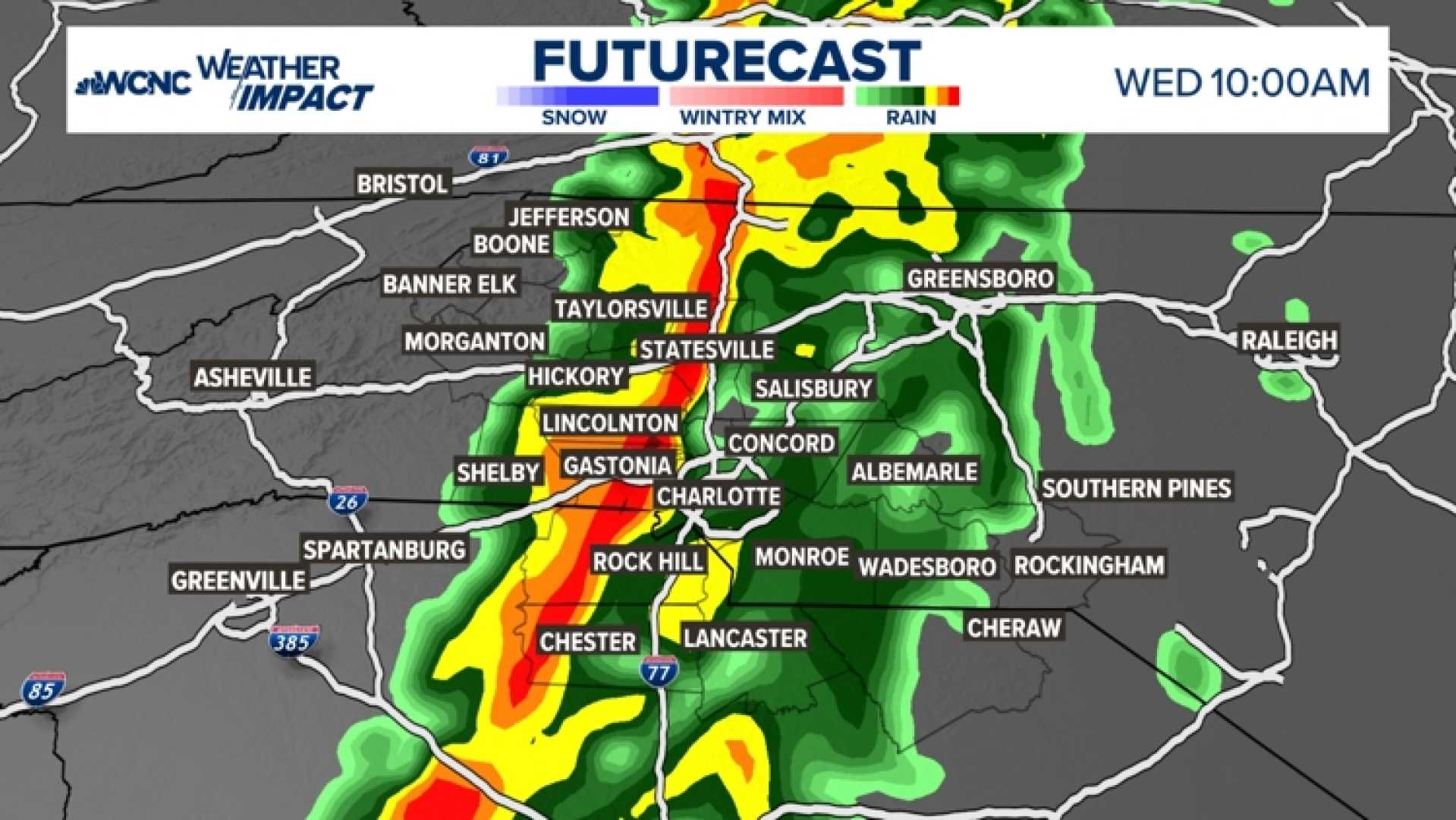
The line of storms will move into the Carolinas from the west, reaching areas such as Boone, Morganton, Hickory, and Shelby by 8 a.m. The storms are projected to enter Charlotte and surrounding locations, including Statesville, Gastonia, Mooresville, Cornelius, Davidson, and Rock Hill, by 10 a.m.
While the intensity and timing of the storms may vary, the overall trajectory remains steady, with severe conditions anticipated as the storms passed through regions affected by a prior severe weather outbreak on Tuesday. According to meteorologists, the strongest impacts may occur both west and east of Charlotte, where daytime heating could intensify the storms.
Local authorities warn of possible impacts from heavy rainfall, which could lead to reduced visibility and road flooding, particularly during the busy morning rush hour. Gusty winds pose the additional threat of downed tree branches and power lines, potentially resulting in widespread outages. An isolated tornado cannot be ruled out.
Travelers are advised to allow extra time for their commutes on Wednesday morning and to consider postponing unnecessary travel to avoid the storms’ most severe portions. Residents should ensure their mobile devices are charged and have multiple channels to receive weather alerts, especially during the overnight hours.
The Storm Prediction Center has placed much of North Georgia and parts of the Carolinas under a watch for severe weather, emphasizing caution for those in the storm’s path.