Severe Storms Threaten Mississippi with Damaging Winds and Tornadoes

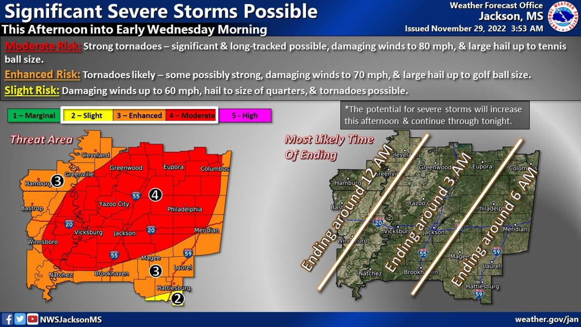
JACKSON, Miss. — A strong cold front swept through central Mississippi on Saturday evening, unleashing heavy rain and severe storms that prompted tornado warnings across the region. The National Weather Service has identified the main threats as damaging winds and possible embedded tornadoes.
As the system moved in, heavy rainfall was expected to add between half an inch and one inch across Central Mississippi. The storm activity is predicted to cease before midnight, giving way to much cooler temperatures that could drop below average by Sunday.
“A fast-moving line of storms is likely to bring strong winds and possible tornado formations,” said David Hartman, a meteorologist at WAPT. Hartman warned residents that the rain could create hazardous conditions as it transitions to cooler weather.
Reports of at least one tornado have emerged from Columbia, Mississippi, where local authorities urged residents to find shelter. Columbia Mayor Justin McKenzie reported debris scattered in the tornado’s wake. “What we believe to be the tornado occurred between Broad Street and Church Street around East Avenue,” he stated. So far, authorities have not reported injuries related to this storm.
Columbia resident Cody Stevens described the panic locals felt as the tornado approached their small community of less than 6,000 people. “It came too close for comfort,” Stevens remarked. According to FindEnergy.com, less than 200 customers lost power in the Columbia area, primarily near the Mississippi River.
Local authorities advised against traveling to densely affected areas to facilitate emergency operations. The Marion County Sheriff’s Office posted on social media, urging the public to stay clear of the Lake View district while first responders assessed the damage.
In Alabama, the National Weather Service reported a “Particularly Dangerous Situation,” with radar indicating debris being lofted over 15,000 feet due to severe weather. Numerous reports surfaced regarding fallen trees and damaged utility lines following the storm system.
An earlier Tornado Watch remained in effect for parts of southern Alabama and Mississippi late into Wednesday evening. Heavy rainfall recorded between 1 to 4 inches across the region heightened the risk of flooding, with minor flooding reported in northern Alabama.
Photos shared by law enforcement in Alabama showed road closures due to flash floods, further complicating travel for local residents. The severe weather threat is expected to diminish by Thursday morning, though the risk persists in southern areas and the Panhandle.
Forecasters predict a significant cooldown following the storms, with temperatures expected to drop significantly over the next week. The Memphis region could also experience a wintry mix as the inversion layer sets in.
The National Weather Service has issued Flood Watches for multiple regions across the Mid-South, including areas in East Arkansas, North Mississippi, and West Tennessee. The warning describes potential excessive runoff and minor flooding in rivers, creeks, and low-lying areas, encouraging residents to stay vigilant.
As the storm patterns shift, many residents are left assessing the impact of the weather and bracing for more severe conditions expected in the coming days.
