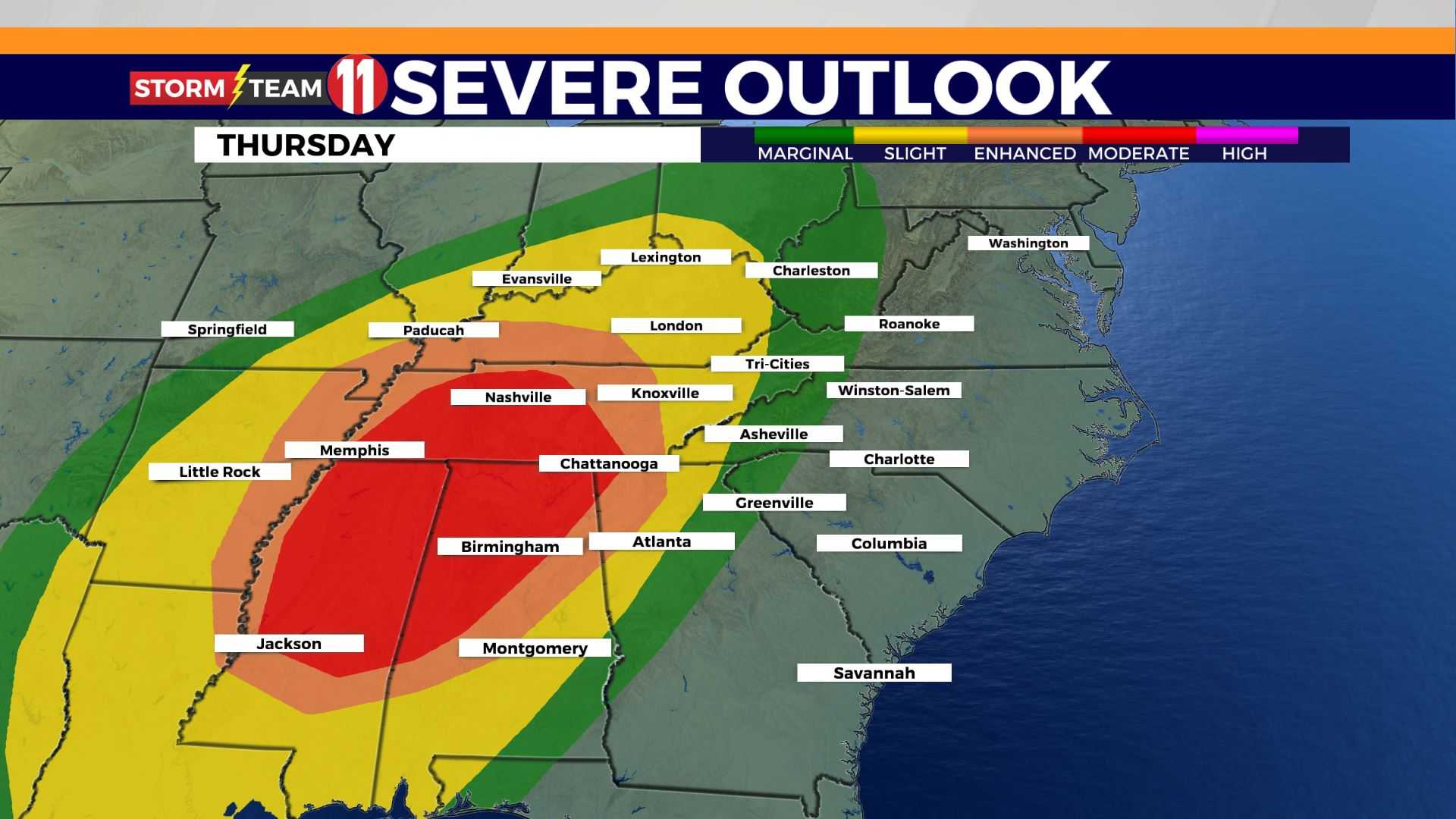
Severe Storms Threaten East Tennessee After Warm Easter Weekend
KNOXVILLE, Tenn. (WVLT) – Following a warm Easter weekend that saw temperatures soar to the mid-80s, residents of East Tennessee are bracing for a shift in weather as a cold front approaches the region. The transition comes as a strong upper-level pressure system moves swiftly northeast through the Great Lakes into Canada, creating conditions for storms late tonight.
The warm temperatures, which were accompanied by increased humidity, will be affected as a frontal boundary moves eastward from the Mississippi Valley tonight. According to meteorologists, the front is anticipated to move slowly, taking about 24 hours to travel from the Mississippi River to the Smoky Mountains. Therefore, the Knoxville area is expected to remain dry through the night and into early Monday afternoon.
“While some storms may become relatively strong, we do not expect a widespread outbreak of severe thunderstorms,” stated a local meteorologist. He noted that gusts could reach 30-40 mph and advised outdoor enthusiasts to make plans accordingly. The first area of storms is likely to hit the Cumberland Plateau and surrounding areas between 4-5 p.m. Monday.
This warm weather has been a welcome reprieve after a dry spell lasting five days. With the anticipated rain from the incoming cold front, models indicate that many areas could receive between half an inch to three-quarters of an inch of rainfall.
Looking ahead, additional chances for rainfall are expected throughout the week as the front lingers near the Tennessee border on Tuesday. A few showers and even a thunderstorm may develop, particularly in southern counties such as Bledsoe, Rhea, Meigs, McMinn, and Monroe.
The forecasts suggest a typical summer pattern with an increased chance for afternoon and evening thunderstorms as we approach the latter part of the week. Local meteorologists predict temperatures will remain above average, with morning lows around 60 degrees and highs in the upper 70s to lower 80s.
In the meantime, the public is urged to stay alert and monitor severe weather updates as conditions evolve.
“We hope to maximize rainfall from this incoming system, especially after a dry weekend,” the meteorologist advised. “Conditions are favorable for some strong storms, so residents should stay informed,” he added.