Severe Weather Alert: Storms Could Hit Midwest This Weekend
Detroit, Michigan — A significant storm system is poised to impact the Midwest this weekend, with severe weather expected across a wide swath of the region, according to meteorologists from the National Weather Service (NWS). From late Friday through Saturday, forecasts predict thunderstorms, potentially severe, along with strong winds and heavy rainfall.
The storm is anticipated to roll into the Lower Peninsula on Friday evening, bringing a series of storms that could produce damaging winds exceeding 45 miles per hour. High temperatures are expected to reach the upper 60s to lower 70s on Saturday, substantially above normal for this time of year.
“The potential for severe thunderstorms is a significant concern, particularly on Saturday afternoon,” said Bryan, a meteorologist from the 4Warn Weather Team. “The weather will transition from unseasonably warm to stormy, so residents should stay vigilant.”
In anticipation of the severe winds, the NWS has issued a Wind Advisory for parts of similar forecast areas, including Medina, Cuyahoga, and Lorain counties. Wind gusts between 40 to 50 mph are expected, raising risks of downed trees and power outages. Residents are advised to secure outdoor items to prevent them from being blown away.
“Gusty winds can easily topple unsecured objects such as trash cans or outdoor furniture,” warned the NWS. “Take precautions to avoid damage.”
Weather models indicate that storms will intensify late Saturday into early Sunday, with potential for heavy rainfall and isolated tornadoes, particularly in the southern regions of Michigan.
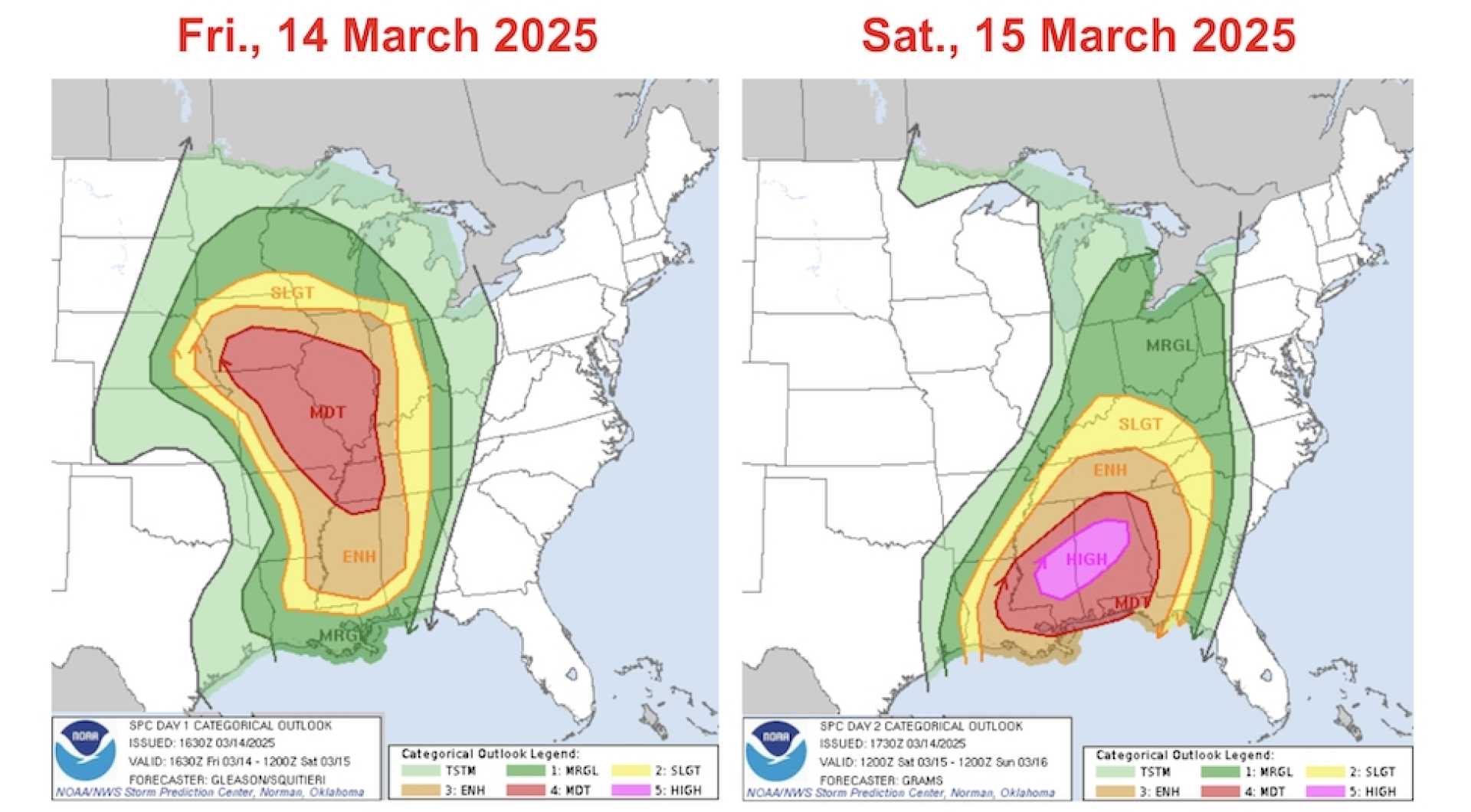
The Storm Prediction Center has placed parts of the region under a Marginal Risk (1 out of 5) for severe weather, while areas farther south, including portions of Alabama and Mississippi, face a High Risk (5 out of 5) due to the threat of tornado outbreaks.
“While it’s unlikely that the worst effects will reach Michigan directly, the outer bands could still produce strong storms,” added Bryan. “We cannot rule out storms becoming severe nor the possibility of isolated tornado activity.”
As the storm system moves through, temperatures are forecasted to sharply decline following the passage of the cold front on Sunday, with highs dropping into the mid-50s and lows in the upper 20s, indicating a significant cool down.
The NWS advises residents to stay updated with weather alerts, especially as the timing for storms and potential severe weather changes closer to the event. A drying trend is expected to follow, with average temperatures returning to the 40s on Monday and climbing back into the 60s by midweek.
Residents across northern Ohio should also brace for stormy conditions Saturday morning, followed by a chance of thunderstorms Saturday evening. Similar to the forecast for Michigan, significant winds and flooding are anticipated.
In light of these developments, the NWS encourages individuals to always be prepared for changing conditions and to heed any alerts regarding severe weather. “Having an emergency plan is crucial,” they advised.