Severe Weather Threat Looms Over Southern Plains on Mardi Gras
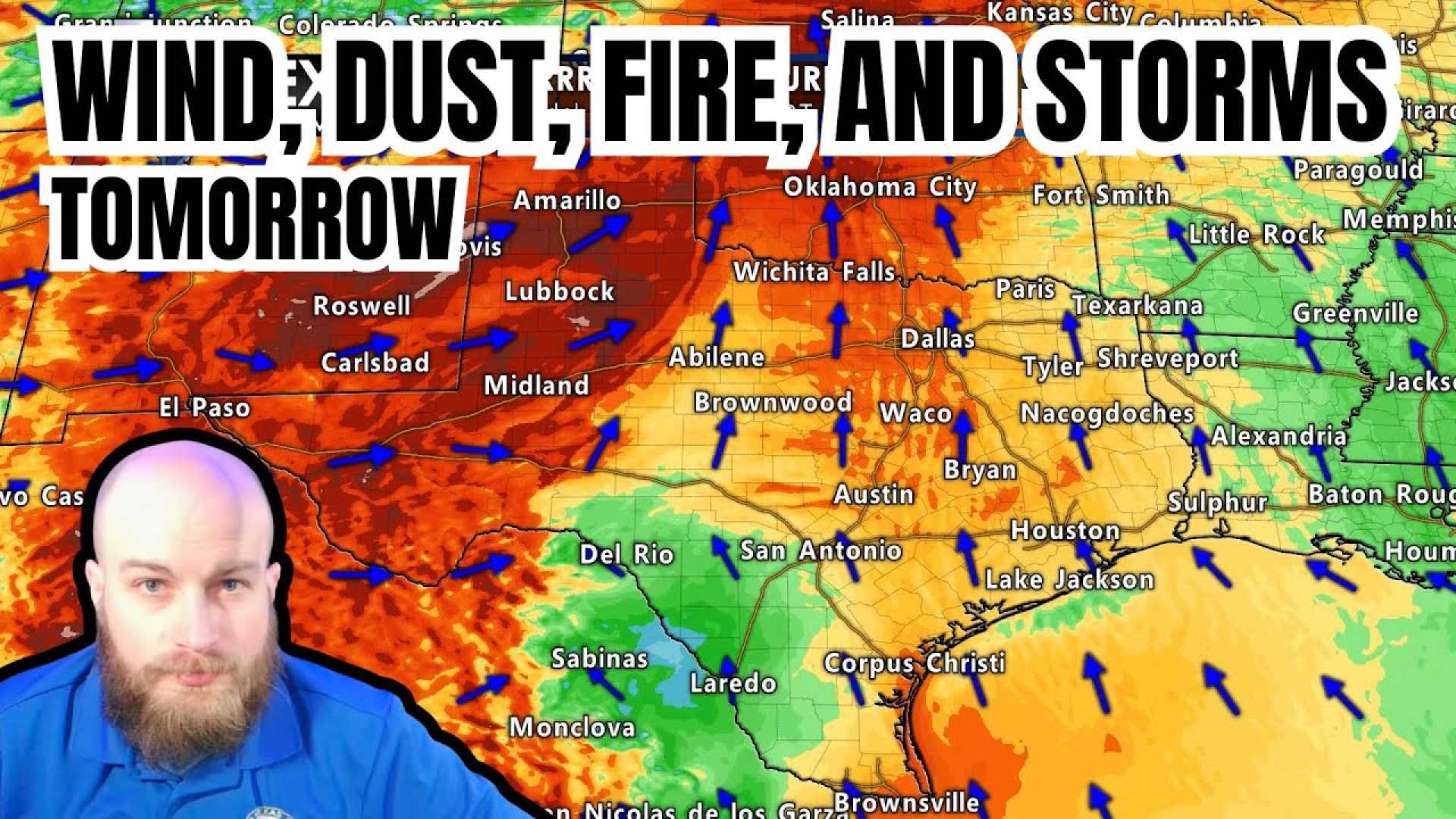
EL PASO, Texas (KFOX14/CBS4) — A weather alert remains in effect for regions across the southern High Plains on March 4, 2025, as strong winds and blowing dust are expected to create hazardous conditions. Winds could gust over 50 mph, particularly impacting areas of El Paso and surrounding regions.
Throughout Monday night, gusts ranging from 30-40+ mph persisted, especially in East and Northeast El Paso. On Tuesday, winds are projected to shift to the northwest, reaching speeds of 35-45+ mph, leading to a potential for blowing dust, though it may not be as dense as seen on Monday due to a change in wind direction. Forecasters are advising residents to limit outdoor activities and use extreme caution when driving.
Amarillo, Texas (KVII) also declared a Weather Alert Day due to similar high wind dangers. Wind gusts could reach a staggering 75 mph, posing severe risks for travel, especially for high-profile vehicles. Roads such as SH-60 and SH-54 have been identified as particularly dangerous under these conditions, with the potential for blowing dust leading to limited visibility.
“Traveling can be extremely hazardous during these high winds,” potential hazards were emphasized by the Amarillo National Weather Service, urging drivers to utilize caution and be mindful of sudden visibility drops caused by blowing dust.
In eastern New Mexico, reports of several accidents were recorded on Monday due to these very conditions. Drivers are advised to turn on headlights and reduce speeds to avoid accidents when encountering reduced visibility.
Temperatures are projected to drop sharply by 10-15 degrees with highs settling in the mid-60s after the weather system passes. A brief round of precipitation may occur Tuesday morning, with the possibility of snow, adding another layer of caution for morning commuters. Blizzard conditions could emerge if visibility falls below 1/4 mile, particularly in the far western and northwestern panhandles.
Across the country, a winter storm is intensifying and shifting east, resulting in thunderstorms, dust storms, and even the potential for tornadoes in the southern U.S. The National Oceanic and Atmospheric Administration warned of this storm’s near-record strength as it moves eastward.
Texas Governor Greg Abbott has placed state emergency personnel on alert, anticipating the dual threats of high fire risks and severe thunderstorms. Several agencies are prepped for potential deployments of firefighting and storm rescue teams throughout the tornado watch areas.
Specific areas in Louisiana and Mississippi are gearing up for severe storms on Mardi Gras Tuesday, with the National Weather Service predicting damaging winds, large hail, and tornadoes for cities like Baton Rouge and Shreveport. Event organizers have adjusted plans to accommodate the forecast, ensuring safety remains the utmost priority.
Jefferson Parish has already canceled some planned Mardi Gras parades due to the safety risks posed by high winds and thunderstorms. “Our top priority is ensuring the well-being of everyone,” stated Jefferson Parish President Cynthia Lee Sheng. As parades are adjusted and may be canceled across areas, local police and emergency services continue to monitor the developing situation closely.
This severe weather event highlights the changing patterns in winter weather and the critical need for community preparedness, as citizens are urged to stay informed and heed safety warnings from local authorities.