News
Severe Weather Threatens Millions with Tornadoes, Flooding in Midwest and Plains

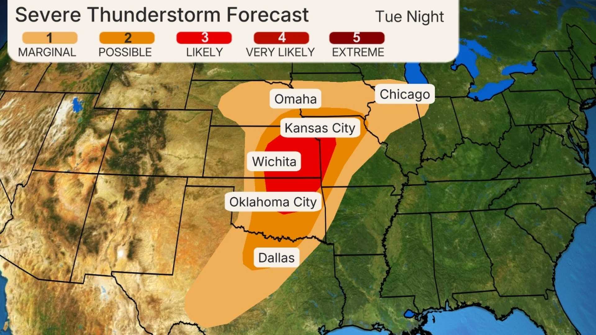
WICHITA, Kan. (KWCH) – A powerful storm system sweeping across the central United States is poised to unleash severe weather affecting over 80 million residents from the Midwest to the East Coast, including tornadoes and flooding, beginning Saturday evening and extending into early next week.
The National Oceanic and Atmospheric Administration’s (NOAA) Storm Prediction Center has issued numerous severe thunderstorm watches, particularly in south-central Kansas, where the highest chances of severe storms are anticipated into the late evening hours. The storms are expected to spread eastward, threatening major cities including Little Rock, Arkansas, and Memphis, Tennessee.
Since Saturday night, the storm has already generated over 500 reports of severe weather, predominantly consisting of damaging winds and large hail. Meteorologists warn that conditions are ripe for supercells capable of producing destructive tornadoes.
“This storm system will bring a variety of hazardous weather impacts, including strong winds, heavy rainfall, and the possibility of tornadoes,” said a meteorologist from NOAA. “Residents in the affected areas should remain alert and prepared for rapidly changing conditions.”
The severe weather threat increasingly intensifies as it moves through the Midwest and into the South on Sunday. Weather experts emphasize the risk of strong tornadoes, particularly across eastern Arkansas, western Tennessee, and Kentucky. Meteorological forecasts suggest heightened risks from Memphis to Indianapolis, with damaging winds exceeding 65 mph likely at times.
In addition to tornado watches, areas such as Baton Rouge, Louisiana, face flash flood warnings as torrential rain leads to significant precipitation accumulations.
“Some areas are already reporting as much as four inches of rain and may receive additional rainfall overnight,” a local meteorologist noted.
As the storm system advocates extreme weather patterns through the evening hours, it’s crucial for communities in the path of the storm to be prepared for potential power outages and property damage. In South Bend, Indiana, reports came in of wind damage that led to downed trees and power lines, with utility tracker data showing over 97,000 customers without power across Indiana as the storm continued.
Looking ahead, additional weather alerts are projected for the coming days as the storm system is expected to dampen upriver conditions, forecasting potential severe storms in the Northeast, from New York City to Washington, D.C. Wind gusts may further exacerbate the situation, especially in urban areas unaccustomed to such severe patterns.
“It’s essential to stay updated with local weather forecasts and heed warnings issued by the National Weather Service,” emphasized the lead meteorologist. “The weather will continue to pose serious threats as we move through the first week of April.”
While some areas will experience scattered severe storms, the potential for heavy rain, high winds, and even snow in western Kansas complicates this weather front further. Temperatures are expected to vary widely, with highs in the 60s to low 70s before plunging in the wake of the cold front.
As residents brace for the oncoming storm, emergency preparedness strategies should be high on everyone’s agenda, particularly in areas deemed susceptible to extreme weather events.


