Severe Weather Threats Loom Over Texas and the Southeast This Week
LUBBOCK, Texas – A complex of storms is continuing to move southeast across Central Texas, bringing concerns of heavy rain and strong winds. The storm system is expected to diminish later this evening, with calm weather anticipated overnight.
On Friday, the forecast indicates a 30% chance of isolated thunderstorms, but most areas are expected to remain rain-free. The weekend looks similarly dry, but meteorologists are keeping an eye on potential storm systems expected to develop by mid-next week.
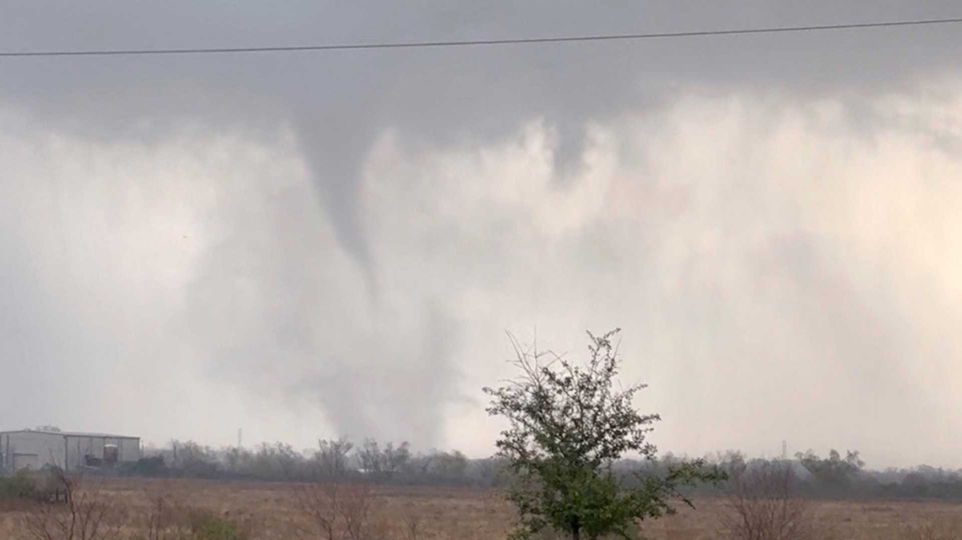
As of 10:44 p.m. Thursday, severe weather had already impacted areas east of Lubbock, with reports of supercells producing large hail and occasional tornadoes. Fortunately, no tornado damages have been reported in populated areas. The Storm Prediction Center has issued a tornado watch for Lubbock and nearby regions.
“The primary risks today are large hail and damaging winds,” said a local meteorologist. “A slight tornado threat exists to the northeast of Lubbock.”
In East Texas, residents are advised to stay prepared for scattered showers this Easter morning. A cold front moving in could trigger thunderstorms, with damaging winds and hail being the main threats. The rain might persist into early Monday morning in southern counties.
Siouxland, with continued rain throughout Thursday, is forecasted to see potential strong storms later in the evening. An enhanced risk for severe storms exists for Monday, particularly as a cold front moves through a warm, humid atmosphere.
In Atlanta, mild and humid weather will persist over the Easter weekend. Though a cold front may bring rain next week, forecasters predict no severe storms for the area. Areas north of I-20 could experience scattered storms as the front stalls.
As storm systems approach, residents are encouraged to stay informed and stay safe this weekend.