News
Winter Storm Demi Threatens Northeast with Snow, Cold, and Travel Chaos

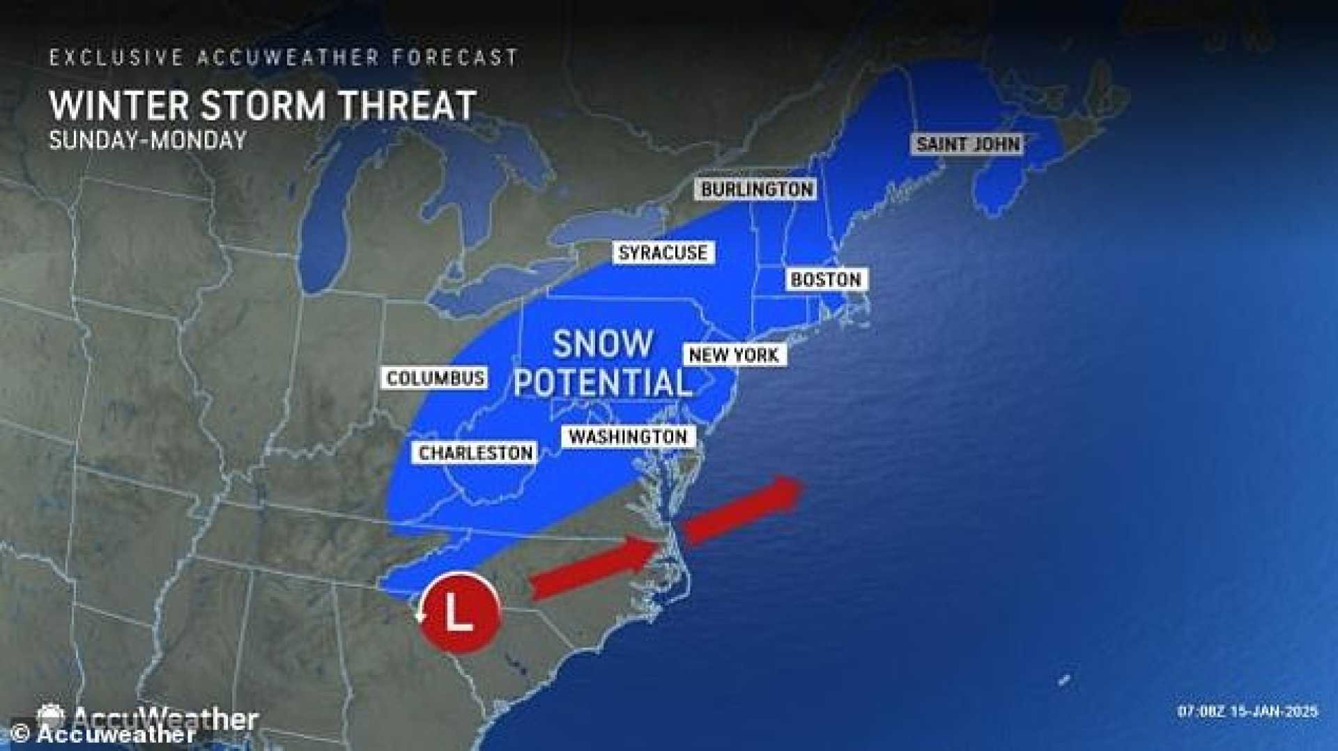
NORTHEAST, U.S. — A powerful winter storm named Demi is set to sweep across the Northeast this holiday weekend, bringing heavy snowfall, frigid temperatures, and potential travel disruptions. The Weather Channel has forecasted significant impacts for major cities, including Philadelphia, Boston, and Washington, D.C., with snowfall expected to complicate travel and outdoor events.
Winter Storm Demi, which formed in the South, is expected to intensify as it moves northward along the Atlantic coast. The storm will bring a mix of rain and snow to coastal areas on Saturday, with heavier snowfall predicted for interior regions of the Northeast and northern New England. By Sunday, the system is expected to shift to snow, particularly along the Interstate 95 corridor, with accumulations of up to 5 inches in Philadelphia and surrounding areas.
“There are still model discrepancies as to how much snow will fall,” said a meteorologist from The Weather Channel. “Much of this depends on how close to the coast the low tracks. If it hugs the coast, we could see more snow in major cities.”
The storm could significantly impact travel, especially for those attending the Rams vs. Eagles playoff game in Philadelphia on Sunday. Slick roads and potential airport delays are expected as the snow continues into Monday morning. The mid-Atlantic region, including Washington, D.C., is also forecasted to see several inches of snow, though the precipitation is expected to clear before the Presidential Inauguration on Monday.
Once the snow subsides, a blast of Arctic air will move in, bringing the coldest temperatures of the season to the Northeast. Boston could experience wind chills as low as minus 10 to 15 degrees, with similar conditions expected across much of New England. “This will be the coldest air mass of the season,” said a weather.com climate writer. “Dangerously cold temperatures will persist through much of next week.”
In New England, the storm’s track remains uncertain, with models predicting anywhere from 2 to 8 inches of snow. The GFS model suggests heavier snowfall along coastal areas, while the Euro model predicts lighter accumulations. “The eventual storm track will determine whether we see a modest snowfall or higher accumulations,” said Dave Epstein, a meteorologist with The Globe. “But Southern New England will definitely see some snow on the ground by Monday morning.”
Residents are advised to prepare for hazardous travel conditions and potential power outages. The storm is expected to move quickly, with most precipitation falling Sunday night and clearing by early Monday. However, the lingering cold will make cleanup efforts challenging. “Be ready to break out the shovels come Monday morning,” Epstein added.


