Winter Storm Warning: Heavy Snow Expected for Southern St. Louis Region

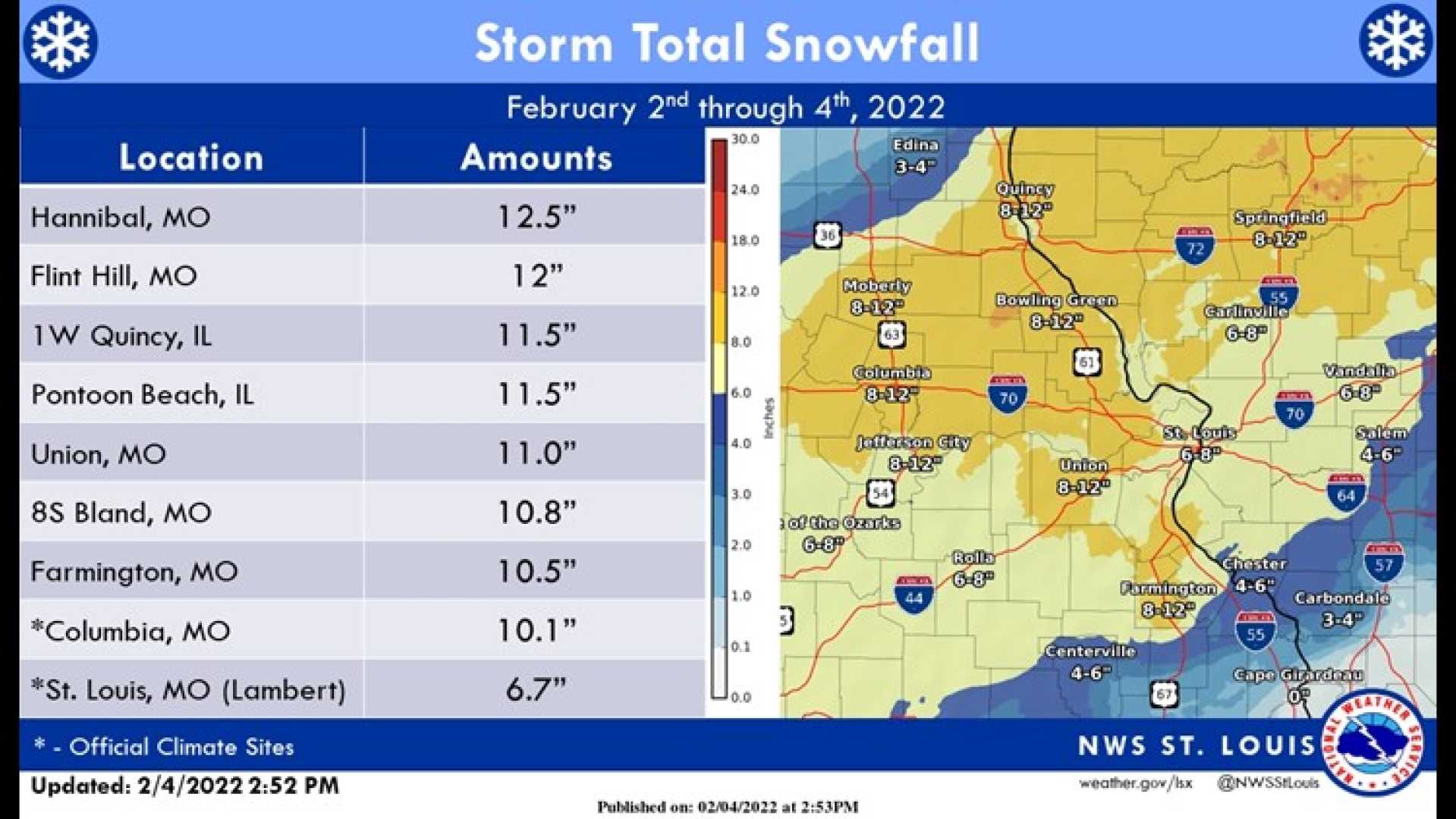
ST. LOUIS, Mo. — A significant winter storm system is set to impact the St. Louis metro area starting early Tuesday, February 17, with snowfall amounts ranging from 1 to 4 inches in the metro and up to 12 inches south of St. Louis.
The forecast indicates that snow accumulation will begin shortly after midnight, continuing through the morning hours. Meteorologists are confident that this storm will produce dry, fluffy snow driven by arctic air, eliminating concerns of sleet or freezing rain this time.
According to the latest updates from the Weather Impact team, areas south of St. Louis are expected to receive the heaviest snowfall, with forecasts estimating between 8 to 12 inches. In contrast, the metro region is anticipated to face less severe totals, generally under 3 inches.
“The main difference this time is the colder temperatures, which will lead to drier, powdery snow. Typically, one inch of water leads to about 10 inches of snow; however, in this case, the ratio could shift to 15 to 20 inches of snow for the same amount of liquid moisture due to the colder air,” said Meteorologist Stacy Lynn.
The storm system will deliver snow through the day, becoming more intense in the evening and into early Wednesday morning. A lighter band of snow is expected to leave a dusting to an inch along the Interstate 70 corridor overnight.
Travel conditions may become hazardous, especially southwest of the metro. Snow is likely to blow across the roads, with wind gusts exceeding 20 mph, significantly reducing visibility. Temperatures will hover in the single digits to low teens throughout the day.
A Winter Weather Advisory is currently in effect for the metro area, while a Winter Storm Warning has been issued for regions to the south where higher snow totals are anticipated. “The timing and consistency of this snowfall contribute to its overall impact, especially in areas south of St. Louis,” added Lynn.
Expect cloud cover and flurries on Monday evening leading into the storm’s arrival. Snow showers may continue into Monday night, providing a dusting of up to an inch before the more substantial snowfall begins on Tuesday.
The weather pattern will persist throughout the week, with temperatures remaining well below freezing, ensuring that any accumulated snow will last for several days. The St. Louis area may even approach a record low of -3 degrees set in 1936.
This winter storm is the first of two significant weather systems forecasted to impact the region this week, with the second system aiming to bring additional snow later on.
