Winter Storm Warning Issued as Snow Forecast Grows for Colorado Front Range
BOULDER, Colo. — A potent winter storm is expected to impact the Colorado Front Range this week, with forecasters predicting up to eight inches of snow for some areas, particularly from late Friday into Saturday. As a series of upper-level disturbances move through the region, temperatures will drop significantly throughout the week, with highs peaking near 60 degrees Monday before cooler weather settles in.
The National Weather Service has already issued a Winter Weather Advisory starting Monday at 9 p.m. for mountain areas, warning travelers of potentially hazardous conditions due to strong winds and fresh snowfall. According to meteorologists, up to 10 inches of snow could accumulate in the higher elevations. “Prepare for changing conditions if you are traveling through mountain passes this week,” said Andy, a meteorologist based in Boulder.
The week’s forecast begins with a warm Monday, where highs are expected to reach the lower 60s due to a southerly flow. However, that is expected to change drastically as a cold front is projected to sweep through the region, bringing unsettled weather into midweek. “Monday will likely be our nicest weather day of the entire week,” Andy added.
As the weather system approaches, rain and snow will likely develop by Tuesday morning, particularly in northeastern Colorado. “Although some rain and snow showers are possible, the downslope winds could keep the Denver area mainly dry,” the meteorologist noted. Winds might gust up to 35 mph, contributing to a chillier landscape, with highs only reaching the lower 50s.
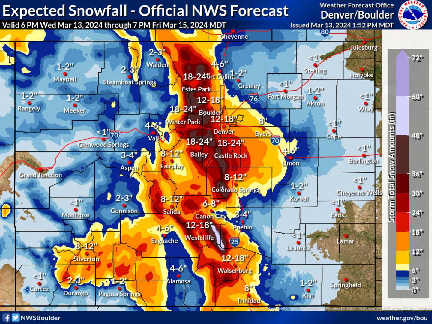
As the week progresses, conditions will become increasingly favorable for significant snowfall. The potential winter storm could begin impacting the Boulder-Denver area late Friday, with forecasters indicating the possibility of heavier snowfall accumulations. Current models suggest that the best chance of accumulating snow will occur late Friday into Saturday.
“While we expect varying models to influence predictions, there is a notable chance for several inches of snow across the lower elevations, including Boulder,” Andy explained. “Our latest guidance indicates a probability of 40% to 60% for four or more inches of snow by the end of the week.”
As temperatures continue to fall, the impacts of the storm are sure to be felt throughout the region. “Even if the snow does not accumulate heavily in urban areas, conditions will remain below average and unsettled through the weekend,” Andy concluded. Residents are encouraged to stay informed via local forecasts and observe any travel advisories as the storm unfolds.