Winter Storm Warnings Issued as Snow Approaches Kentucky and Indiana
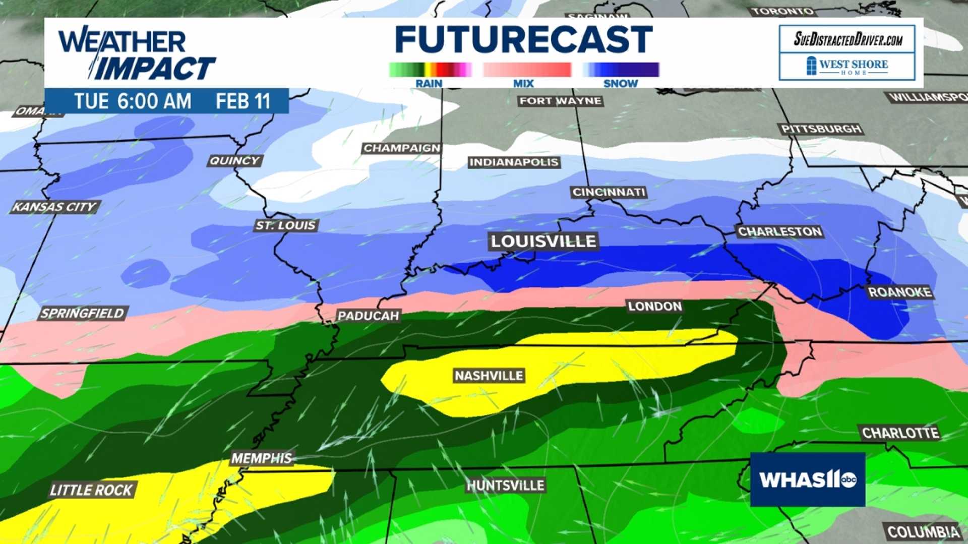
LOUISVILLE, Ky. – A winter storm warning has been issued for multiple counties in Kentucky and Indiana as a significant winter weather system is expected to arrive early Tuesday morning. Meteorologists predict snowfall to begin between 5 and 6 a.m., with accumulations ranging from 2 to 5 inches across the WLKY viewing area.
Chief Meteorologist Jay Cardosi reported that conditions will be calm this evening, with temperatures around 43 degrees and clear skies. However, a shift in weather is anticipated late tonight as moisture from the west will bring a mixture of rain and snow.
“During the first half of the night, we will see quiet conditions, but after 3 or 4 a.m., wet snow will start developing,” Cardosi said, urging residents to prepare for changing conditions. “Early tomorrow morning, much of the region will encounter accumulating snow.”
In Jefferson County, schools are already planning to transition to non-traditional instruction (NTI) on Tuesday, with alarming flu activity noted by local health officials. Dr. Kris Bryant from the Louisville Metro Department of Public Health and Wellness added, “Flu season is in full swing, and children are being especially affected this year.”
Forecast models show a sustained period of snowfall through midday, especially affecting areas north of the Bluegrass Parkway. The southern regions will experience more mixed precipitation, with rain expected to dominate.
“Expect heavy snow within the winter storm warning area, particularly in Jefferson County, Oldham County, and surrounding regions,” Cardosi noted. “After the main energy pulls away late in the afternoon, snowfall rates will decrease.”
The National Weather Service has strongly advised residents to stay updated as conditions evolve. A total of 2 to 5 inches of snow is anticipated, particularly where the precipitation falls primarily as snow rather than rain.
For commuters, delayed and canceled services are likely on Tuesday, and travel could be hazardous during the morning hours. The community is urged to stay informed about closures affecting schools, businesses, and other public services.
“While this storm may not be as intense as the previous winter systems, it can still lead to dangerous travel conditions,” Cardosi warned. “Be mindful of the wet snow accumulation and changing road conditions.”
As more developments unfold, the WLKY team will provide regular updates on closures and weather alerts. Residents can access updated information through the WLKY app and website for detailed forecasts.