News
Winter Weather Hits Northern California with Rain and Snow
SACRAMENTO, Calif. — Northern California is bracing for a significant winter storm on Friday, with forecasts predicting widespread rain and low snow as the system moves in overnight. The snow level is expected to drop to 1,500 feet in the early hours, shifting to rain within a few hours later. The KCRA 3 weather team has categorized Friday as a weather Impact Day due to the potential for wet roads and accumulating snow in higher elevations.
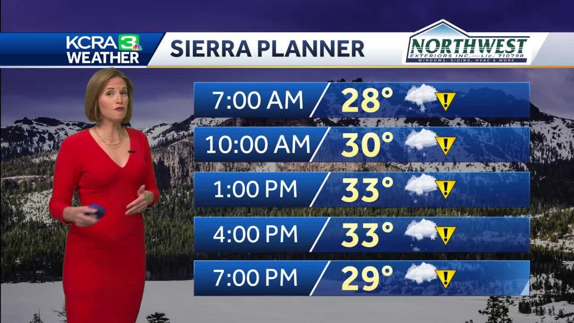
Moderate to heavy precipitation is expected to start ahead of sunrise, particularly impacting areas above 2,000 feet. Communities at this elevation could see snow accumulations ranging from two to three inches, particularly in locales like Pollock Pines and Georgetown, where an accumulation of six to eight inches is likely. Mountain drivers should anticipate chain controls and travel delays amidst heavy snowfall and gusty winds.
The valley regions are forecasted to experience rainy conditions, with wind gusts reaching 20 to 30 mph throughout the morning. While the rain may lighten by the afternoon, scattered showers are anticipated to continue into the evening, adding up to less than a quarter of an inch of rainfall total for most areas.
Temperatures across the valley are expected to remain around 10 to 15 degrees below average for mid-March, primarily lingering in the low to mid-50s. The foothills will stay cooler, with temperatures in the 40s and getting close to freezing in the Sierra.
Looking ahead, another round of precipitation is set to arrive on Sunday evening, bringing both rain and snow back to the area. Preliminary forecasts suggest that the snow may once again accumulate significantly in the mountains, complicating travel over the weekend.
“It’s crucial for drivers to stay alert and take caution while on the roads, especially in higher elevations,” said KCRA 3 Meteorologist. “We’ll see a considerable amount of snow in mountainous regions, which could lead to hazardous travel conditions.”
Mountain travel is especially discouraged as temperatures drop, and storms are likely to produce white-out conditions intermittently. The National Weather Service has issued multiple advisories, emphasizing the potential for reduced visibility and dangerous travel conditions.


