Severe Heat and Storms Expected Across Midwestern States
ROC Chester, Minn. (KTTC) – A hot and humid day is underway in Rochester as temperatures soar into the upper 80s and low 90s. With a heat index expected to reach the low 100s, officials have declared today as a First Alert Day. A Heat Advisory will be in effect from noon until 8 PM.
Abundant sunshine will dominate the skies, but a line of strong thunderstorms is forecast to develop in the northwest and move through the area between 5 PM and 11 PM. The storms may bring damaging wind gusts and heavy rainfall, with the most intense activity predicted to hit Rochester around 7 PM to 8 PM.
After the storms pass, a few stray showers and thunderstorms are possible overnight and into early Thursday morning. Tomorrow’s conditions are expected to be more comfortable, with high temperatures in the low 80s and slightly lower humidity.
The weekend forecast indicates a return to warmer, more humid weather, with highs in the mid-80s on Saturday and approaching 90 degrees on Sunday. Both days are expected to be designated as First Alert Days due to heat index values nearing 100 degrees.
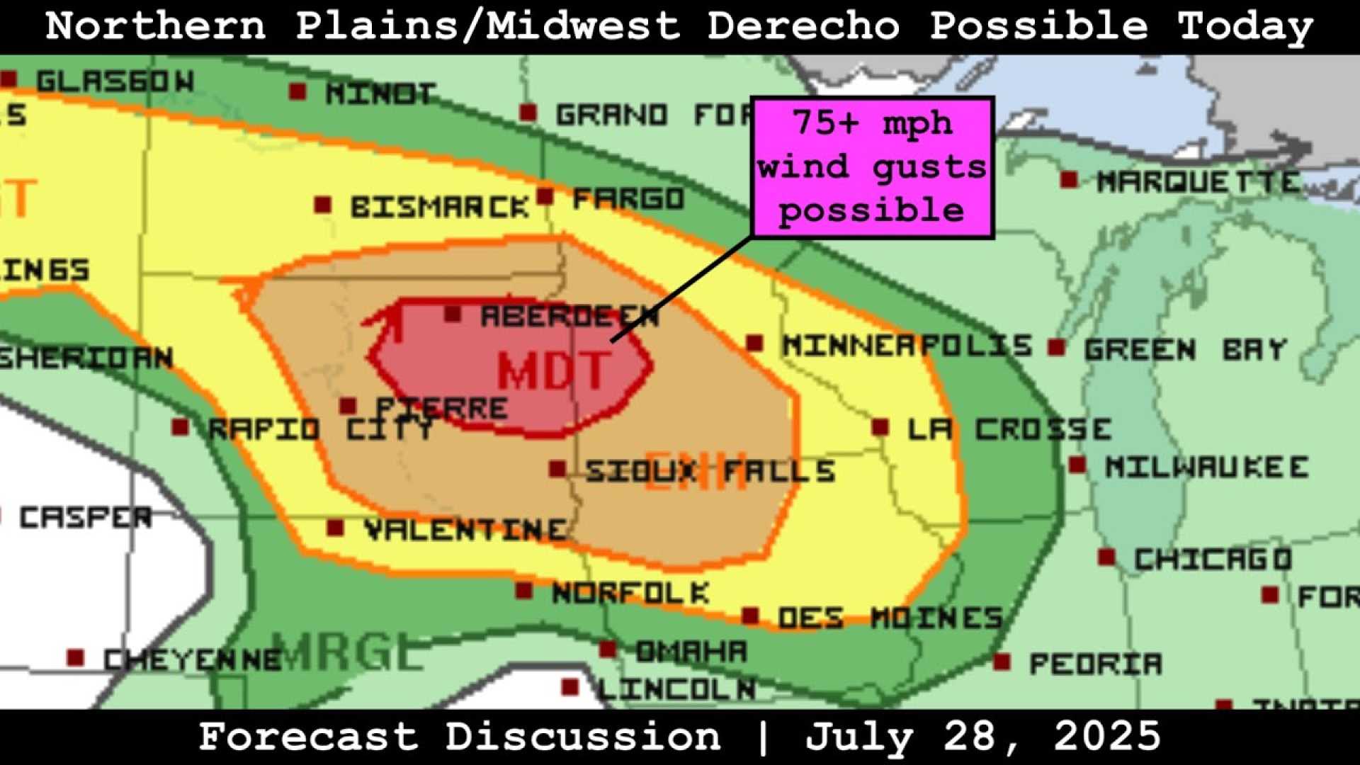
Meanwhile, in Sioux City (KTIV), the heat continues with Monday highs reaching the mid-90s. Heat index values could climb between 100 and 115 degrees during the afternoon. Severe weather is also expected to develop, with much of South Dakota and southwestern Minnesota under a Moderate and Enhanced risk of severe storms.
This area is monitoring the possibility of a derecho, with the best chances of severe conditions noted for counties along and north of HWY 20. The most likely timing for dangerous winds may be between 8 PM and 12 AM Tuesday morning, with gusts potentially exceeding 70 miles per hour.
Tuesday will still be hot and humid, with highs in the 80s and low 90s. However, it will be a more sunny day ahead of expected thunderstorms Tuesday night into Wednesday. Rainfall amounts could be excessive as the storms roll in, leading to cooler conditions after Wednesday with temperatures dropping into the 70s and 80s by the weekend.