News
Winter Storm Watch Issued for Massachusetts Ahead of Tuesday’s Snow
BOSTON, Massachusetts — A winter storm is expected to impact Massachusetts and the surrounding areas on Tuesday, prompting local weather teams to declare it a NEXT Weather Alert day. The National Weather Service has issued a Winter Storm Watch for regions north and west of Interstate 95, affecting southern Vermont, New Hampshire, and Maine as well.
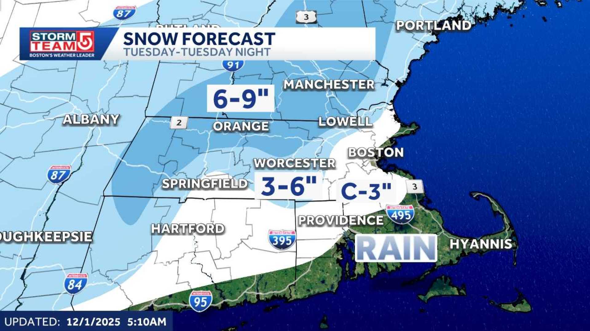
The winter storm watch indicates possible snow accumulations of six inches or more. If forecasts remain consistent, this watch may evolve into a winter storm warning within 24 hours of the event. Though categorized as a nor’easter, forecasters do not anticipate the strong winds typical of such storms.
The snow is expected to begin during the morning commute on Tuesday, with conditions gradually deteriorating throughout the day. By 10 a.m., precipitation will transition to snow across southern New England, with rain in southern areas. Weather-related traffic disruptions are not anticipated before 9 a.m., but conditions will worsen quickly afterward.
As the storm progresses, roads north and west of Interstate 95 will become covered in snow, making travel challenging, especially during the evening commute. Forecasters estimate that the rain/snow line will fluctuate near the Interstate 95 corridor.
Snow accumulation estimates vary. Areas in the Berkshires and northern Worcester County may receive 6 to 12 inches. Regions between Interstate 95 and Interstate 495 could see 3 to 6 inches, while the immediate coastline from Cape Ann to Boston may only see 1 to 3 inches of snow, with rain expected predominantly in those areas.
For Cape Cod and the Islands, primarily rain is forecasted. Snow is expected to taper off from 8 to 11 p.m., with final precipitation concluding shortly after midnight.
Residents are advised to prepare their vehicles for winter conditions. A cold snap is expected later in the week, with temperatures potentially dipping below zero.


