Iowa Faces Hot, Humid, and Stormy Week Ahead
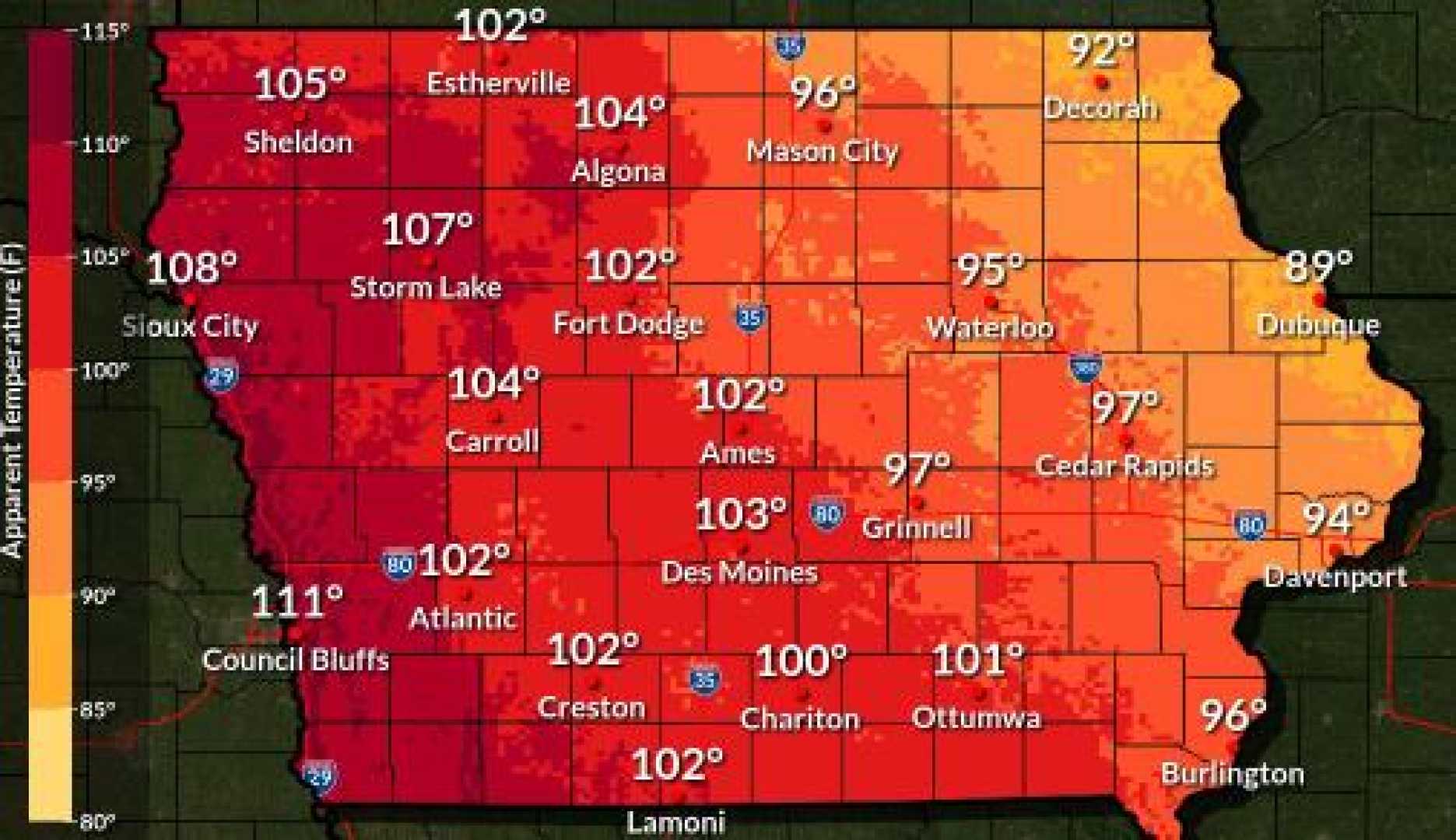
DES MOINES, Iowa — Residents in Iowa are bracing for a hot, humid, and stormy start to the week. On Monday, forecasts predict temperatures reaching the low 90s, accompanied by high humidity levels that will make it feel closer to the triple digits.
Scattered thunderstorms are expected to develop throughout the day, particularly in central and southern parts of the state. As of Monday morning, storms are anticipated to intensify, bringing the potential for heavy rain, strong winds, and isolated hail. Conditions are suitable for localized flooding as storms pass through.
While tornado threats remain low due to weak low-level winds, Iowans are reminded to remain cautious during their morning commute as wet conditions may persist. Forecasters suggest that anyone traveling should stay alert for rapid changes in weather.
By the afternoon, additional storms may coincide with rush hour around 5 p.m., adding to the challenges of the evening commute. The heat index may push to 100 degrees in southern areas of the state, adding to oppressive heat that Iowans have faced recently.
Looking ahead, meteorologists expect a gradual decrease in temperatures and humidity levels later in the week, particularly by Wednesday. Residents can expect a mix of clouds and sunshine, with further cooling by the weekend.
“We’ll start feeling some relief from the heat and humidity by midweek,” a local meteorologist stated. “It looks like a more comfortable weekend is on the horizon.”