News
Severe Thunderstorms Forecast to Hit Mid-South on Sunday Night
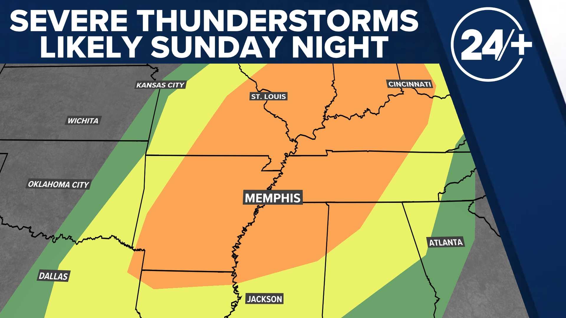
MEMPHIS, Tenn. (WMC) – Sunday will mark a First Alert Weather Day across the Mid-South, with expectations of strong to severe thunderstorms affecting the region. Storms are set to develop in Arkansas and advance eastward into the Mid-South on Sunday evening and overnight.
Forecasts indicate the potential for severe weather, including large hail, strong winds, and even isolated tornadoes. McNairy and Alcorn Counties are likely to be the last areas affected, with storms expected to clear by around 4 AM Monday. Consequently, the Monday morning commute is not anticipated to be disrupted by thunderstorm activity.
Conditions are projected to improve on Monday, with developing sunshine making for a tranquil afternoon. Highs will reach the middle 60s, followed by mostly clear skies at night with lows in the middle 40s.
However, weather-related excitement is still on the horizon. A second First Alert Weather Day has already been announced for Wednesday, when a new system is expected to bring additional showers and thunderstorms, possibly more severe than those on Sunday. Meteorologists are currently monitoring this impending weather event, as numerous variables could influence its severity.
Thursday also presents potential weather concerns, though it is not officially classified as a First Alert Weather Day. The region may face risks of hail, wind, and heavy rainfall, raising concerns about possible flooding.
Weather expectations for the rest of the week include scattered thunderstorms on Friday, with the likelihood of more storms into the following Sunday, April 6th. However, signs indicate a diminishing chance of rain by the first full week of April.
During Sunday night into Monday morning, expect mostly cloudy skies with patches of scattered thunderstorms, some of which may reach severe levels. Temperatures will cool into the upper 50s overnight.
In summary, residents of the Mid-South should remain vigilant regarding the weather situation as the weekend unfolds, especially during the expected storm events in the coming days.


