Severe Weather Forecasted Across Eastern U.S. This Weekend
BINGHAMTON, N.Y. — A significant storm system is expected to impact the eastern two-thirds of the United States this weekend, bringing a mix of rain, snow and severe weather as it moves eastward.
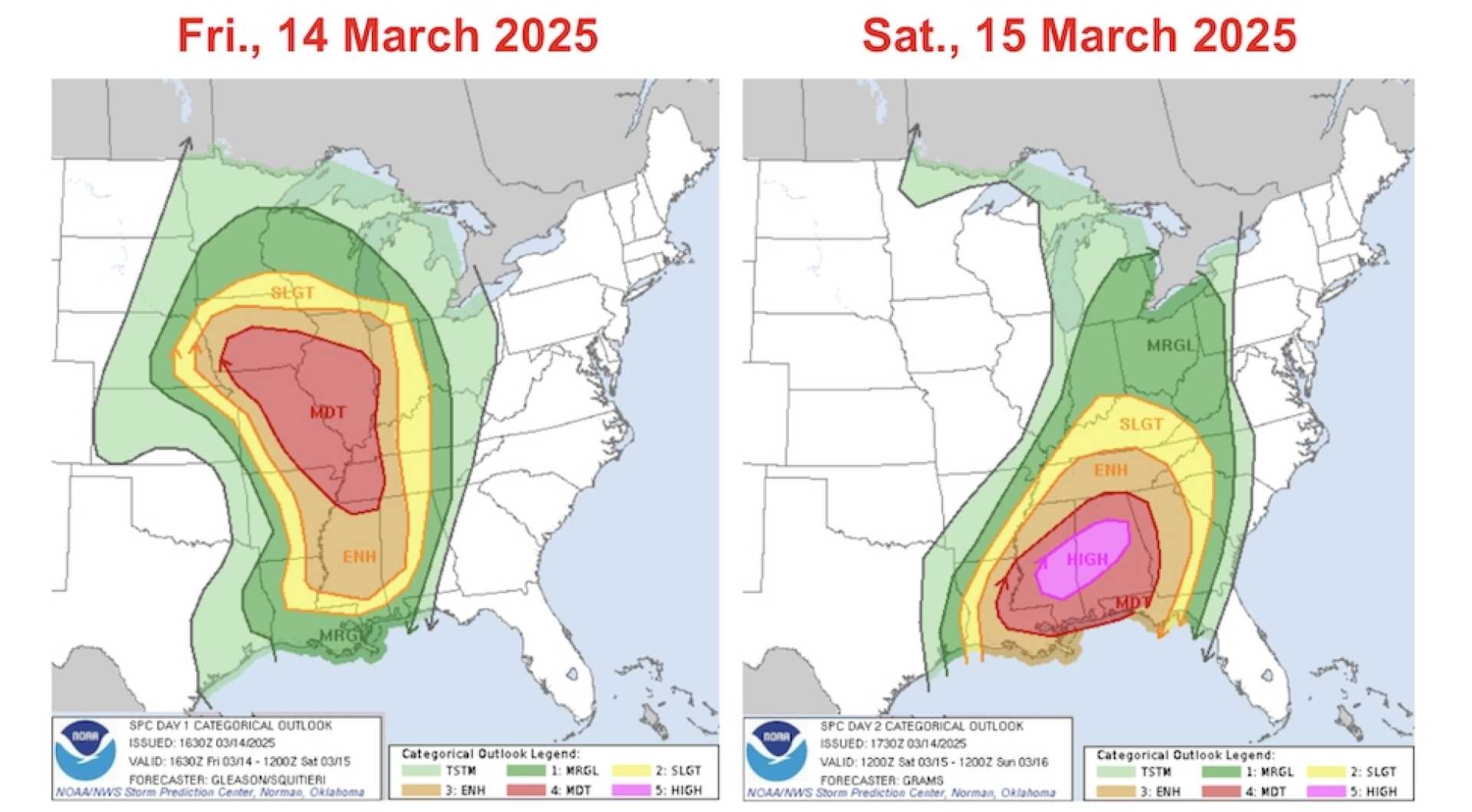
The National Weather Service predicts that much of this system will be centered over the Central U.S. on Saturday, March 14, with a cold front advancing into the Great Lakes, Ohio Valley and Deep South. This front is likely to trigger severe thunderstorms in the affected areas, prompting residents to remain vigilant.
“Prepare for heavy rain, damaging winds, large hail, and potentially a few strong tornadoes,” warned Alyssa Robinette, a WeatherBug meteorologist. The areas most at risk for severe weather include the Deep South stretching into the Ohio Valley, continuing through Sunday.
As temperatures drop behind the cold front, wintry precipitation is expected for the northern Plains, with conditions likely to include snow, sleet and freezing rain. Rain will persist across the Upper Mississippi Valley on Saturday morning before transitioning to snow by the afternoon.
In the West, a Pacific storm system will bring moderate rain to western Washington and Oregon, and those in higher elevations can expect light to moderate snowfall. Areas as far south as northern California may also see a rain and snow mix due to this influx of moisture.
“Expect milder temperatures across southern California and in parts of the Desert Southwest,” noted Robinette. Highs will reach the 50s and 60s across central to northern regions, while the Deep South and southern Plains can expect warm 70s and even 80s in Texas and Florida.
By Sunday, the large storm system will make its way across the Eastern U.S., pushing toward the Atlantic Ocean. Rain and thunderstorms are anticipated for the Ohio and Tennessee valleys and then rolling into the East Coast. The severe weather outbreak may persist with the potential for dangerous thunderstorms from Florida to New England.
“We are continuing to monitor conditions as they develop,” Robinette added, referring to potential threats across several states.
In Binghamton, local meteorologist Jake Chalupsky noted that residents should prepare for a warm yet wet weekend. “Friday will remain dry and sunny, with highs around 63 degrees. However, rain showers and thunderstorms are forecasted for Saturday and Sunday,” he said. “Saturday will present a 20% chance of rain, while Sunday looks significantly wetter.”
In Memphis, Friday will bring mostly sunny skies with highs in the lower 80s, giving way to a 90% chance of rain and thunderstorms later in the night. Rain will remain a theme as the weekend progresses, with highs dropping significantly by Sunday.
In Columbus, the National Weather Service issued a wind advisory for areas anticipating gusts between 50 to 60 mph, especially on Saturday. The forecast also warns of possible severe thunderstorms with a risk of tornadoes developing in the region, as conditions warrant close attention.
Residents are urged to stay tuned to local forecasts and prepare for dynamically changing weather conditions as the weekend approaches.