News
Severe Weather Threats Loom Across the West and Central U.S.
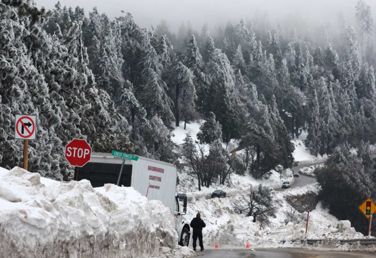
KENNEWICK, Wash. — A powerful atmospheric river is set to impact California and the Pacific Northwest this week, bringing heavy snowfall, rain, and strong winds that could lead to dangerous travel conditions. The weather system is expected to arrive late Tuesday and continue through Thursday.
This storm follows a series of weather fronts affecting the region. A cold front currently moves southeast from British Columbia, generating breezy to windy conditions in the surrounding areas. Mountains, particularly in the Washington Cascades and Blue Mountains, are forecasted to see snowfall accumulations ranging from 1 to 6 inches as the system makes its way through.
According to meteorologist forecasts, California’s Sierra Nevada could receive up to 4 feet of snow, with significant rain predicted across the lower elevations. Residents are warned about the potential for flash flooding and debris flows caused by excessive rainfall, particularly in the aftermath of recent wildfires. The National Weather Service has issued winter storm warnings effective from Tuesday night.
The National Weather Service’s (NWS) office in Los Angeles cautioned, “Flash flooding and debris flows caused by excessive rainfall are possible, especially in areas impacted by burn scars.” Widespread heavy rain expected include 2 inches or more in various southern California regions, with 2.18 inches anticipated in Pine Mountain and nearly 1.5 inches in Santa Barbara.
Meanwhile, a high wind warning has been issued for the Mojave Desert slopes, predicting gusts of 30 to 65 mph. This could create dangerous conditions including downed trees and power lines, as strong winds precede the approaching storm.
Scott Homan, senior meteorologist with AccuWeather, stated, “We will see rain pushing into northern California and various locations in the Northwest during the night.” The NWS warns that the storm’s strength will continue to increase, particularly as it moves across the Rockies, setting the stage for severe weather throughout the central United States.
Forecasts indicate that strong winds, possibly exceeding 50 mph, could affect regions as far east as the Southern Plains. Homan noted, “As the powerful storm’s cold front interacts with warm, moist air from the Gulf, we expect severe thunderstorms that could stretch over 800 miles through the Mississippi Valley.”
Travel could be extremely hazardous, especially in mountainous areas. The public is urged to stay informed about the evolving weather conditions and to prepare for potential disruptions.


