News
Heavy Rain and Tropical Development Threaten Florida Over Holiday Weekend
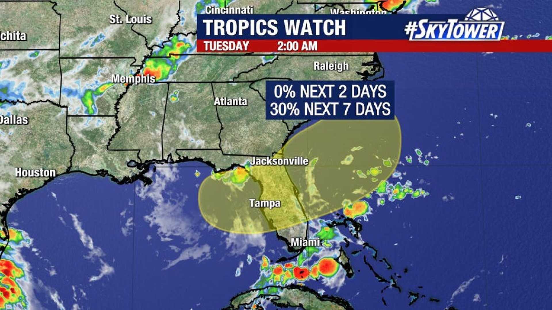
TAMPA, Fla. — The National Hurricane Center (NHC) reported that an area of low pressure may develop off the Southeast coast during the Fourth of July weekend, bringing heavy rain and thunderstorms to Florida. Millions of residents and visitors are closely monitoring the weather as holiday plans could be disrupted.
The NHC is keeping a watchful eye on an area of disturbed weather expected to produce tropical activity. Forecasters have highlighted a medium chance for development throughout the week.
According to meteorologists, environmental conditions may support slow development while the system lingers near the southeastern Atlantic or Gulf coasts. Regardless, Florida is anticipated to experience significant rainfall due to a stagnating weather front.
As weather patterns evolve, torrential rainfall and thunderstorms are likely across the Florida Peninsula, particularly over the weekend. Regions from the Gulf Coast southward and parts of the Atlantic coast may see several inches of rain that could impact Fourth of July festivities.
Forecasters from the Weather Prediction Center (WPC) have placed much of Florida under a Level 1 out of 4 flood threat in the upcoming days, indicating the potential for flash flooding. Gulf Coast areas face an elevated Level 2 threat on Wednesday and Thursday.
On Friday, as holiday plans take place, the flood threat will adjust slightly, with a broad region in Central Florida still under a Level 1 warning. However, the risk of flooding will remain for portions of the Gulf coast into Saturday.
The situation is dynamic, and meteorologists are urging residents to prepare for changing weather conditions as Fourth of July celebrations approach.


