News
Denver Braces for First Snow and Hard Freeze of the Season

A significant weather change is impending for Denver and northern Colorado, with the first snow of the season and a hard freeze expected in the coming days. According to the latest forecasts, a storm system is bringing rain and snow to the high country, with some mountain neighborhoods already experiencing accumulating snow by Tuesday morning.
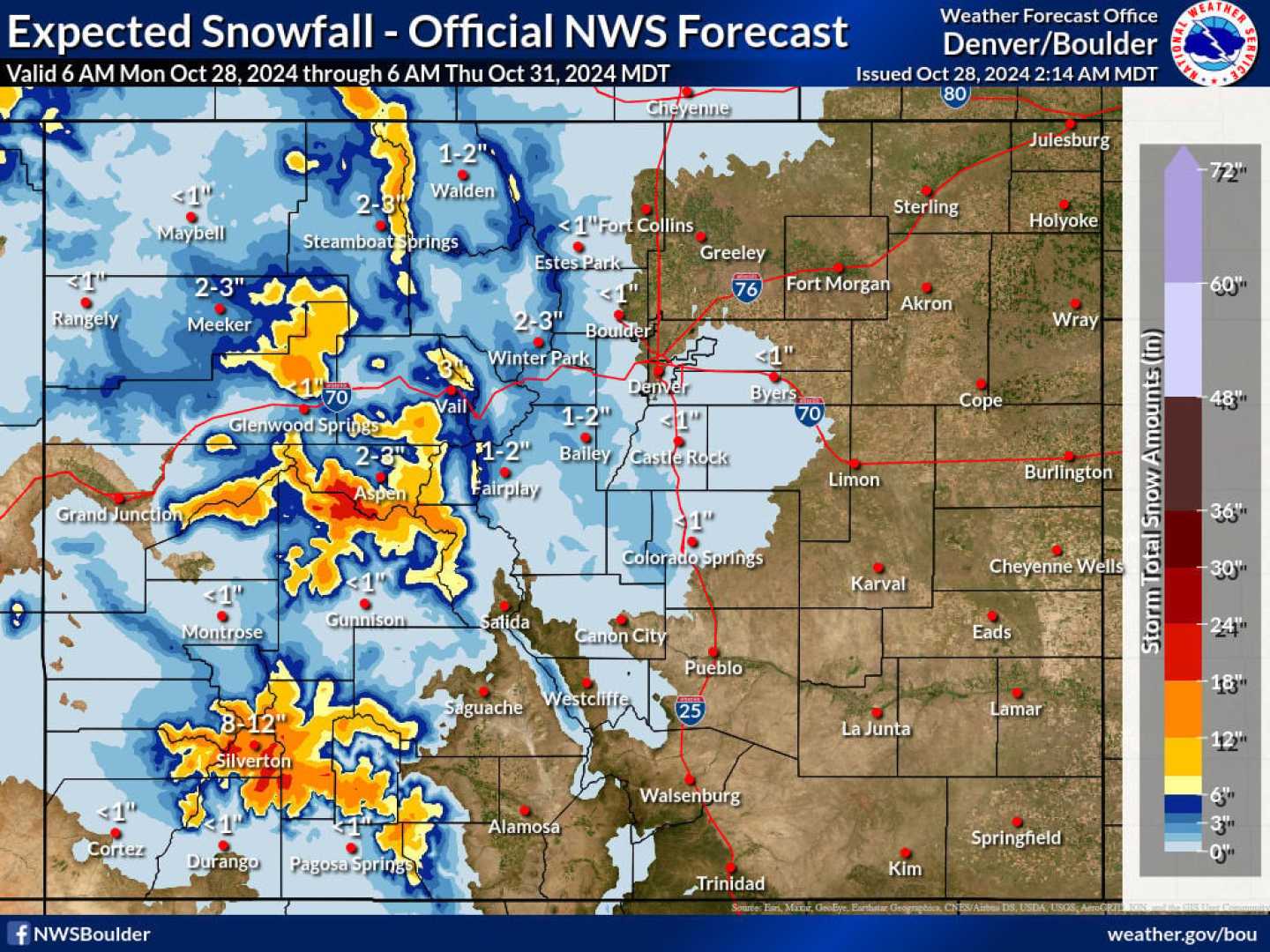
The Denver metro area and the Front Range can expect spotty showers on Tuesday afternoon, with a higher chance of rain and snow overnight. By Wednesday, Denver may see its first snowflakes, although minimal accumulation is anticipated, with only a dusting possible on roofs and grassy surfaces.
Areas above 7,000 feet, near the foothills, and in the Palmer Divide are likely to receive less than 1 inch of snow through Wednesday. Meanwhile, Eastern Colorado remains under Red Flag Warnings and High Wind Warnings due to high fire danger, with winds gusting up to 55 mph and warm, dry conditions facilitating rapid fire spread.
Freeze watches will be in effect for the I-25 corridor and parts of Eastern Colorado from Wednesday night to Thursday morning, with temperatures expected to drop into the low 20s. However, temperatures are forecasted to rise back into the 50s by Thursday afternoon, making for a cooler but dry Halloween evening.


