News
Flash Flood Threat Grows in Northeast Amid Heavy Rain Forecast
NEW YORK – The Northeast is facing an increasing risk of flash flooding due to persistent rain and thunderstorms expected over the next several days, according to FOX Weather Meteorologists Britta Merwin and Ari Sarsalari.
The FOX Forecast Center reports that a blocking weather pattern, referred to as an “Omega block,” is stalling a system over the Ohio Valley. This system is drawing moisture from the Atlantic Ocean, greatly impacting the region. Merwin explained, “A cutoff low means that it’s cut off from the main flow, meaning that there’s nothing around to steer it, and it doesn’t move very fast at all. So, this thing is going to linger around the East Coast for a couple of days.”
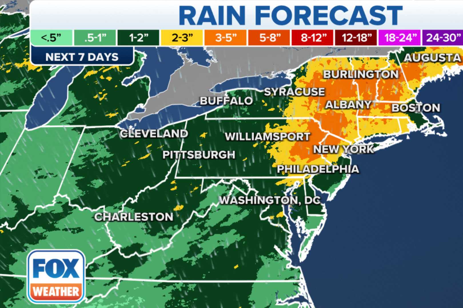
Rain totals could range from 3 to 5 inches if the system remains stalled. However, forecasters note that the timing and location of heavier rain bands may vary over the coming days. They expect the rain bands to be narrow, resulting in occasional heavy bursts and the potential for thunderstorms.
While significant flash flooding appears unlikely due to the scattered nature of the storms, the Weather Prediction Center has issued a Level 2 out of 4 risk for areas in Connecticut and New York, among other regions. The anticipated flash flooding risk includes the Catskills and Poconos in New York and Pennsylvania, as well as southern Connecticut.
On Sunday, an area of low pressure is projected to begin stalling over the Ohio Valley, with moisture feeding into the Northeast. This setup is expected to lead to scattered downpours, particularly near New York’s Catskills and Pennsylvania’s Poconos. FOX Weather meteorologist Jane Minar stated that residents should expect breaks in the rain, but still anticipate several rounds of heavy showers through at least Tuesday.
Rainfall totals across much of the Northeast could reach 2 to 3 inches by mid-week, with isolated areas potentially receiving up to 5 inches. The FOX Forecast Center mentions that while initial rains may help alleviate ongoing drought conditions, substantial rainfall later may introduce flash flooding risks.
The Weather Prediction Center has issued a multiday flood outlook covering regions from Charleston, West Virginia, up to Washington, D.C., and Hartford, Connecticut, beginning Saturday and continuing into Monday.


