News
Severe Storms Cause Fatalities and Widespread Damage Across Central U.S.
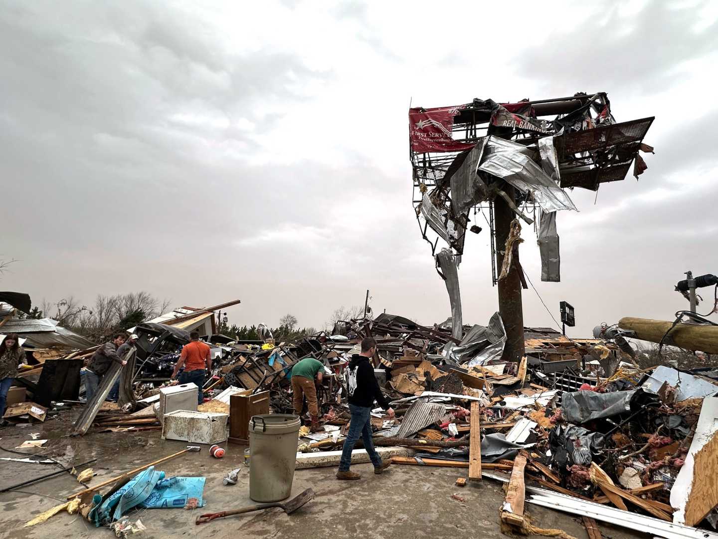
INDIANAPOLIS, Ind. – At least two fatalities were reported Sunday as severe weather ravaged the central United States, prompting more than 70 Tornado Warnings and over 300 storm-related incidents. FOX Weather continues to monitor the threat of further storms into Monday morning.
The severe weather event spanned from the southern Great Lakes to Texas and Louisiana, unleashing damaging winds, large hail, and confirmed tornadoes. Sunday was notably active, marking the second most severe weather day of the year, trailing only March 14, when over 600 incidents were documented.
By the start of the week, more than 100,000 residents were without power, as they brace for the possibility of additional storms. Sgt. Benjamin McFalls of the Porter County Sheriff’s Department confirmed that one man died in Indiana after strong crosswinds caused his tractor-trailer to tip over.
Another death occurred in Millersburg, Indiana, where a thunderstorm wind overturned an Amish buggy at a highway intersection. Tornado sightings were reported in several states, including northeast Arkansas, where one tornado was captured on camera moving through the area Sunday evening.
The Storm Prediction Center documented wind gusts reaching 85 mph near Illinois and 96 mph in Michigan, contributing to widespread destruction. FOX Weather meteorologists reported on-site from Arkansas, where they encountered large hail while tracking the storms.
As the severe weather system progressed eastward, a considerable population of approximately 92 million, from the Southwest to the central Gulf Coast, remained under threat for additional severe conditions as the new workweek began.
Tornado Watches were issued for multiple states as emergency management reported impassable roads due to severe weather. The National Weather Service noted that areas in northern Jackson County experienced substantial rainfall, with totals between 6 and 8 inches, and additional rainfall of 2 to 4 inches anticipated.
Looking forward, strong to severe thunderstorms are expected to impact areas from the Northeast southwestward to the central Gulf Coast on Monday, with a level 2 out of 5 severe weather risk identified. In contrast, a level 3 out of 5 risk covers portions of Virginia, the Carolinas, Alabama, and the Panhandle, where damaging winds may down trees and power lines, resulting in further power outages.
The forecast for midweek suggests the potential for additional severe weather, particularly from central and northeastern states toward northwestern Louisiana. Large hail is expected to be a primary concern, with a similar severe weather risk area emerging on Wednesday that mirrors past occurrences.
As the storms continue through the week, another round of severe thunderstorms could arise on Thursday, extending from Ohio to the Ark-La-Tex region, indicating a prolonged threat of hazardous weather conditions.


