Severe Storms Expected Across Midwest and South This Weekend
KALAMAZOO, Mich. — Severe thunderstorms are expected to develop across the Midwest and South on Sunday, with the potential for damaging winds and large hail impacting areas from eastern Texas to the southern Great Lakes.
The Storm Prediction Center has issued a level 2 out of 5 risk for severe weather across most of West Michigan, while a level 3 risk extends to areas to the south. The timeline for potential severe thunderstorms is between 3 p.m. and 9 p.m., starting southwest of Kalamazoo before moving northeast.
“While we anticipate severe weather, the exact strength and impact are still uncertain,” said meteorologist Lynne Kasey. “Morning rain could limit the severity, but breaks in the clouds could amplify storm potential later in the day.”
The primary threats from the expected storms include damaging wind gusts and large hail. An isolated tornado is also possible as the atmospheric conditions, characterized by moisture and wind shear, are conducive to severe weather development.
For instance, on Saturday, a wind gust of 85 mph was recorded in Baxter Springs, Kansas, causing roof damage and downed trees. Significant hail was also reported in Oklahoma, with stones measuring up to 2.5 inches in diameter near Bridge Creek and Amber.
As the severe storms advance throughout Sunday, they will be accompanied by a cold front that could bring a dramatic temperature drop. By Monday morning, lows are expected to fall into the middle 30s, with potential rain and snow showers continuing the transition from winter to spring.
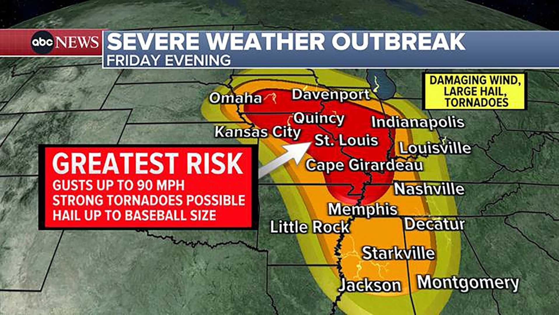
According to updates from the National Oceanic and Atmospheric Administration (NOAA), widespread severe thunderstorms will persist through the overnight hours into Monday, affecting the East Coast. Areas in the Midwest, which recently experienced a major weather outbreak, are under close watch.
The forecast warns that as March concludes, the severe weather threat will extend to various states including Indiana, Kentucky, Arkansas, and Tennessee, with possibilities of powerful storms throughout the day.
The next several days indicate a continuation of severe weather patterns, with another significant low-pressure system expected to impact the Midwest and Ohio Valley midweek. Meteorologists urge residents to stay informed and prepared.