News
Tornado Warning Issued for Southeast Idaho Amid Severe Weather
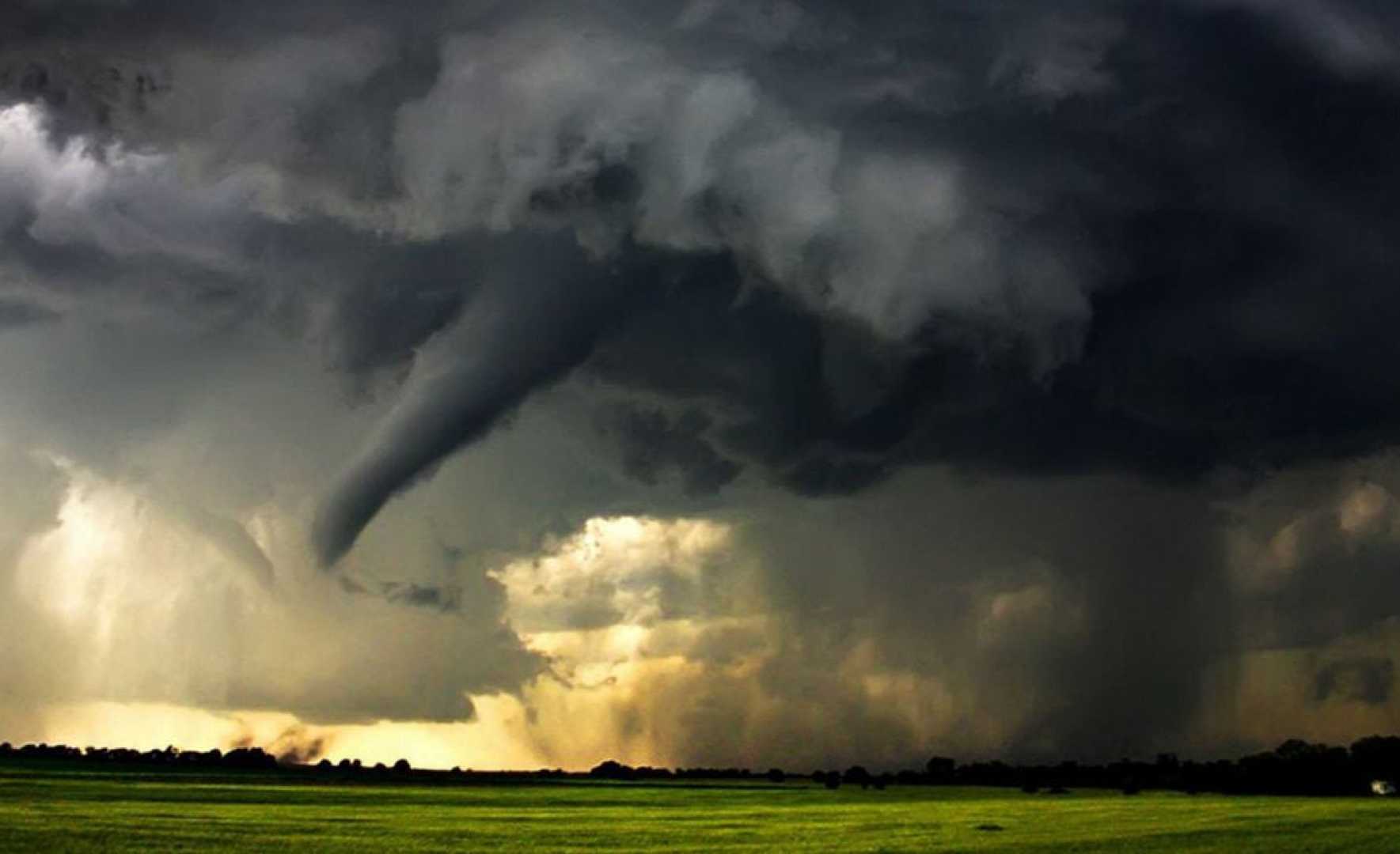
Pocatello, Idaho — The National Weather Service has issued a Tornado Warning for Central Oneida County, South Central Bannock County, and Southeastern Power County in Southeastern Idaho until 3:15 PM Wednesday.
As of 2:42 PM, a severe thunderstorm capable of producing a tornado was detected 12 miles northeast of Juniper, approximately 20 miles north of Snowville, moving east at 40 mph. The storm poses a threat of tornadoes and golf ball-sized hail.
Officials warn that flying debris can be dangerous for anyone caught outside or without shelter. Mobile homes may be damaged or destroyed, and damage to roofs, windows, and vehicles is likely. The storm is expected to primarily affect rural areas, including Daniels Reservoir.
Precautionary measures are urged. Residents should take cover immediately by moving to a basement or an interior room on the lowest floor of a sturdy building and avoid windows. Those outdoors, in mobile homes, or in vehicles should seek solid shelter to protect themselves from debris.
Earlier in the day, the National Weather Service issued a severe thunderstorm watch for 10 East Idaho counties, including major cities like Pocatello, Chubbuck, and Idaho Falls, valid until 9 PM Wednesday. Multiple severe thunderstorm warnings and tornado warnings have been reported throughout East Idaho.
As of 4:30 PM, no tornadoes have been reported to have touched down, but heavy rain, strong winds, and large hail have caused damages in some areas.
The counties under the watch include Bannock, Bear Lake, Bingham, Bonneville, Caribou, Franklin, Fremont, Madison, Oneida, and Teton, affecting local cities such as Inkom, McCammon, Arimo, and many others.
Residents should stay tuned for updates as weather conditions may worsen.


