News
Southeast Louisiana Prepares for Early Summer Heatwave This Week
NEW ORLEANS, La. — Early summer heat is building across Southeast Louisiana this week as the big storm system departs. Residents can expect a marked increase in temperatures starting Tuesday, May 13.
Tonight, the area will experience what may be the last cool evening and morning until fall, with temperatures dipping to around 59 degrees on the Northshore and 64 degrees in the city. But that comfort won’t last long, as forecasters predict high temperatures reaching the upper 80s by Tuesday.
According to the latest weather report, the humidity levels will remain manageable with dew points in the 60s. However, there is a slight chance—less than 20%—of light rain late Tuesday night or early Wednesday morning.
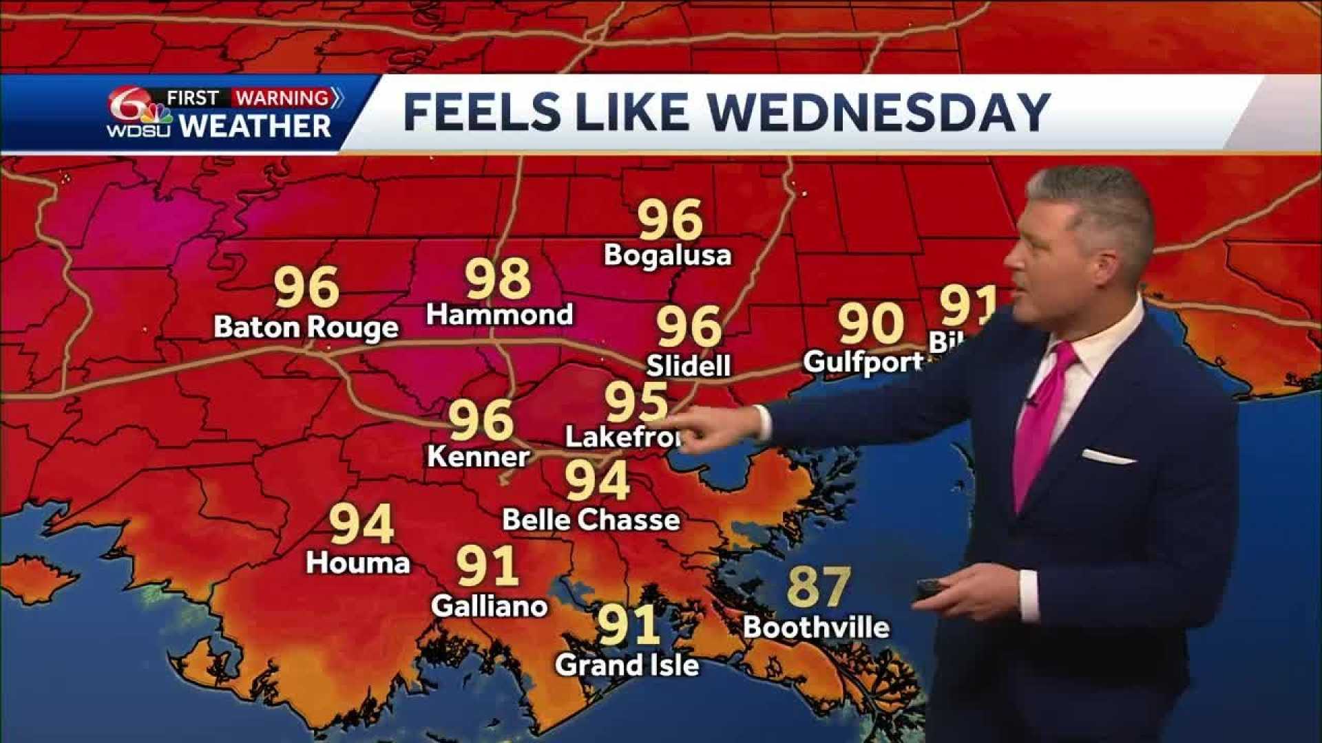
Wednesday’s forecast shows a few clouds with no significant chance of rain. Winds from the southwest are expected to elevate temperatures close to 90 degrees. The humidity will start to increase, impacting the heat index.
On Thursday, dew points are projected to rise above 70, causing the heat index to feel like 97 degrees in New Orleans, with actual temperatures around 90 degrees. By the weekend, the heat will intensify, with expected highs around 91 degrees and heat indices reaching up to 100 degrees.
A weak front may provide a slight chance of showers for the Northshore but will not significantly affect the hot weather pattern. Residents should prepare for persistent heat into next week, as rain chances remain slim.
Stay cool and hydrated as the summer heat settles in!


