News
Heavy Rain Expected in Jacksonville This Week Due to Tropical System
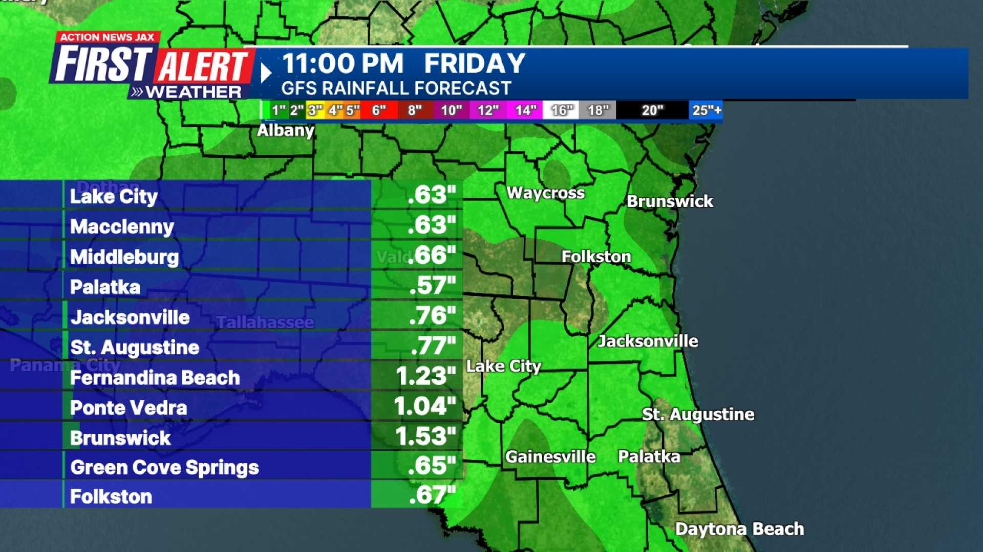
Jacksonville, FL — A low-pressure system will bring heavy rains to Jacksonville and surrounding areas from Wednesday to Thursday, with some coastal regions expecting over 2 inches of rain.
The National Hurricane Center alerts residents to prepare for increased rainfall as the system circulates off the coast. An east to southeast wind will shift to a westerly direction by Friday, reducing precipitation levels.
The National Hurricane Center marked the system as having a 10% chance of development. It is primarily influenced by a weak upper-level low pressure moving through Florida, creating a surface trough extending from the eastern coast of Florida to the Carolinas.
Local meteorologists warn that while Jacksonville may not face a direct impact from a developed storm, the nearby areas could still be affected. “Expect heaviest rain near the coast, tapering off inland,” a meteorologist stated.
Rip current risks will be heightened along the coast as winds strengthen, prompting authorities to advise caution for beachgoers. “It’s important to stay informed about current conditions, especially if you’re heading to the beach,” the meteorologist added.
Looking ahead, forecasters are monitoring the Western Caribbean and Southern Gulf for potential development around mid-June. Although predictions are inconsistent, tropical conditions are generally more favorable in these regions during early hurricane season.
The Atlantic hurricane season lasts from June 1 to November 30, and has begun with its first named storm, Andrea. Names for storms are selected by the World Meteorological Organization and are reused every six years, barring any retirements following particularly devastating storms.
Residents are reminded to stay updated on forecasts. “While social media can be misleading, official updates will provide accurate information,” the meteorologist cautioned.


