News
Severe Storms and Tornado Warnings Loom for Indiana and Illinois
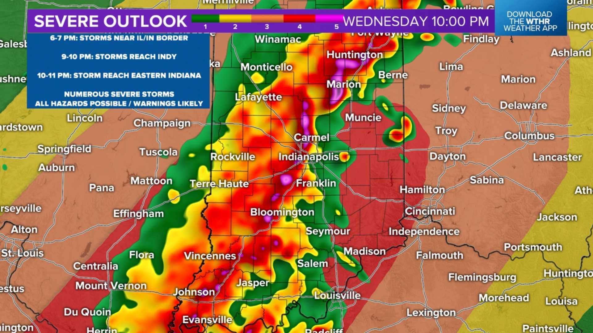
INDIANA, USA — Severe thunderstorms and tornado warnings are issued as a line of storms approaches the Illinois–Indiana border. The storm is expected to sweep across Indiana today, with the most intense conditions occurring between 2 p.m. and 7 p.m. EDT, particularly in Indianapolis from 3:30 p.m. to 6 p.m.
The National Weather Service advises residents to treat both thunderstorms and tornado warnings seriously due to the potential for destructive wind gusts. Warnings have been issued for damaging winds up to 70 mph, especially in southern Indiana, where the highest threats are expected.
A hot and humid air mass over Indiana is fuelling these storms. A weak cold front moving in today is likely to trigger multiple rounds of thunderstorms, particularly later in the afternoon and evening.
Heavy rainfall is also anticipated, with local flash flooding possible. Rain may come in waves, and flooding concerns could increase if storms train over the same areas, similar to incidents earlier in the week which resulted in road closures in parts of the region.
While the risk of tornadoes remains low, there is an increased likelihood of severe thunderstorms in the area. The possibility of large hail exists, but much of it may melt before reaching the ground. Quarter-sized hail could be possible, along with isolated reports of larger hail.
Humidity and instability in the air may cause storm clusters to develop rapidly, complicating the timing and intensity of severe weather. Experts suggest that if storms develop gradually, they may be stronger due to a greater chance to intensify.
As the cold front passes through early Thursday morning, a warm summer pattern will return, bringing elevated temperatures and humidity. Residents are advised to stay hydrated and limit outdoor activities during peak heat hours this afternoon.
Stay tuned for live updates and weather warnings through local news channels and weather apps.


