News
Severe Thunderstorm Watch Issued for Southeast Michigan
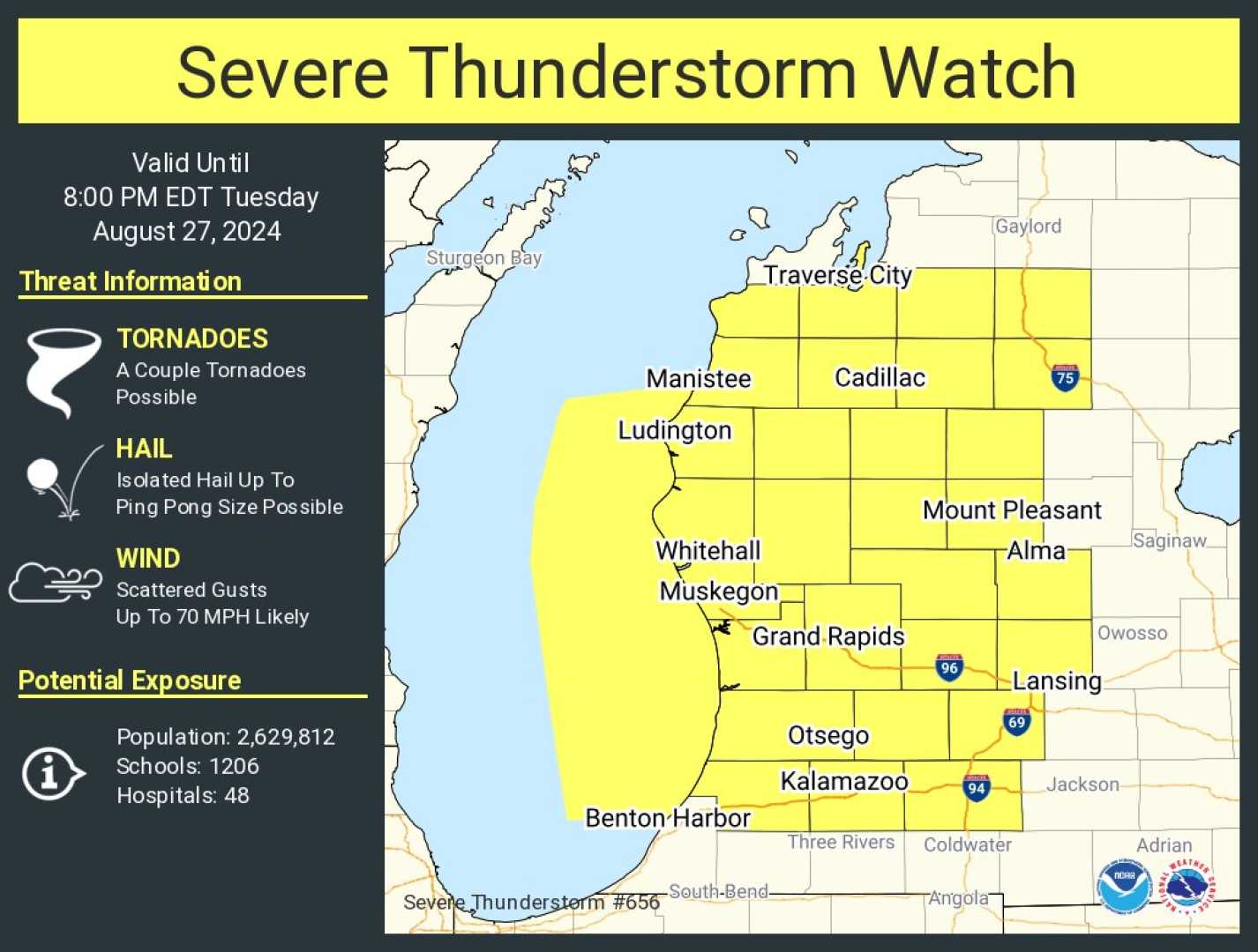
MID-MICHIGAN (WJRT) – The National Weather Service has issued Severe Thunderstorm Watch 436, effective until 10 PM EDT on June 18, 2025, for 11 counties in Southeast Michigan. The affected areas include Genesee, Lapeer, Lenawee, Livingston, Macomb, Monroe, Oakland, Shiawassee, St. Clair, Washtenaw, and Wayne.
This watch encompasses several cities, including Adrian, Almont, Ann Arbor, Brighton, Canton, Dearborn, Durand, Ferndale, Flint, Fowlerville, Howell, Imlay City, Lambertville, Lapeer, Lincoln Park, Livonia, Marysville, Monroe, Novi, Owosso, Pontiac, Port Huron, Redford, Royal Oak, Southfield, St. Clair Shores, Sterling Heights, Taylor, Temperance, Troy, Warren, Waterford, and Westland.
The Storm Tracker 12 Weather Team has declared an Alert Day for the threat of severe thunderstorms expected to develop late in the afternoon and continue into the night. The primary hazards include high winds and heavy rainfall, particularly in the Great Lakes Bay Region and northern parts of Mid-Michigan. Hail and tornadoes are also possible.
Morning rain or clouds on Wednesday may diminish the storm’s severity; however, increased sunshine in the afternoon could exacerbate conditions. To prepare for the severe weather, Consumers Energy has put 485 crews on standby. Utility crews from neighboring states are also en route to Michigan to help manage potential power outages.
David Hicks, an officer at Consumers Energy, emphasized, “We know how challenging summer weather can be, from heatwaves to sudden storms. Our crews are ready, and our systems are being monitored around the clock.”
Temperatures in the northern parts of Mid-Michigan are forecasted to reach the low to mid-70s, while southern areas may approach 80 degrees. Overnight temperatures will drop to the low 60s with muggy conditions. A gradual return to sunshine is expected on Thursday, with highs reaching the upper 70s.
The weekend will usher in very hot weather with temperatures likely hitting the low 90s by the Summer Solstice. The Storm Tracker 12 Weather Team has declared Alert Days for the upcoming Sunday and Monday, with expected high temperatures in the mid-90s and heat index values surpassing 100 degrees. Mornings may have low temperatures in the mid-70s, providing little relief from the heat.
Residents are encouraged to stay tuned to ABC12 for updates on cooling centers and preparations for the impending heat wave.


