News
Rare Funnel Clouds Form Near Salinas and Hollister, NWS Investigates
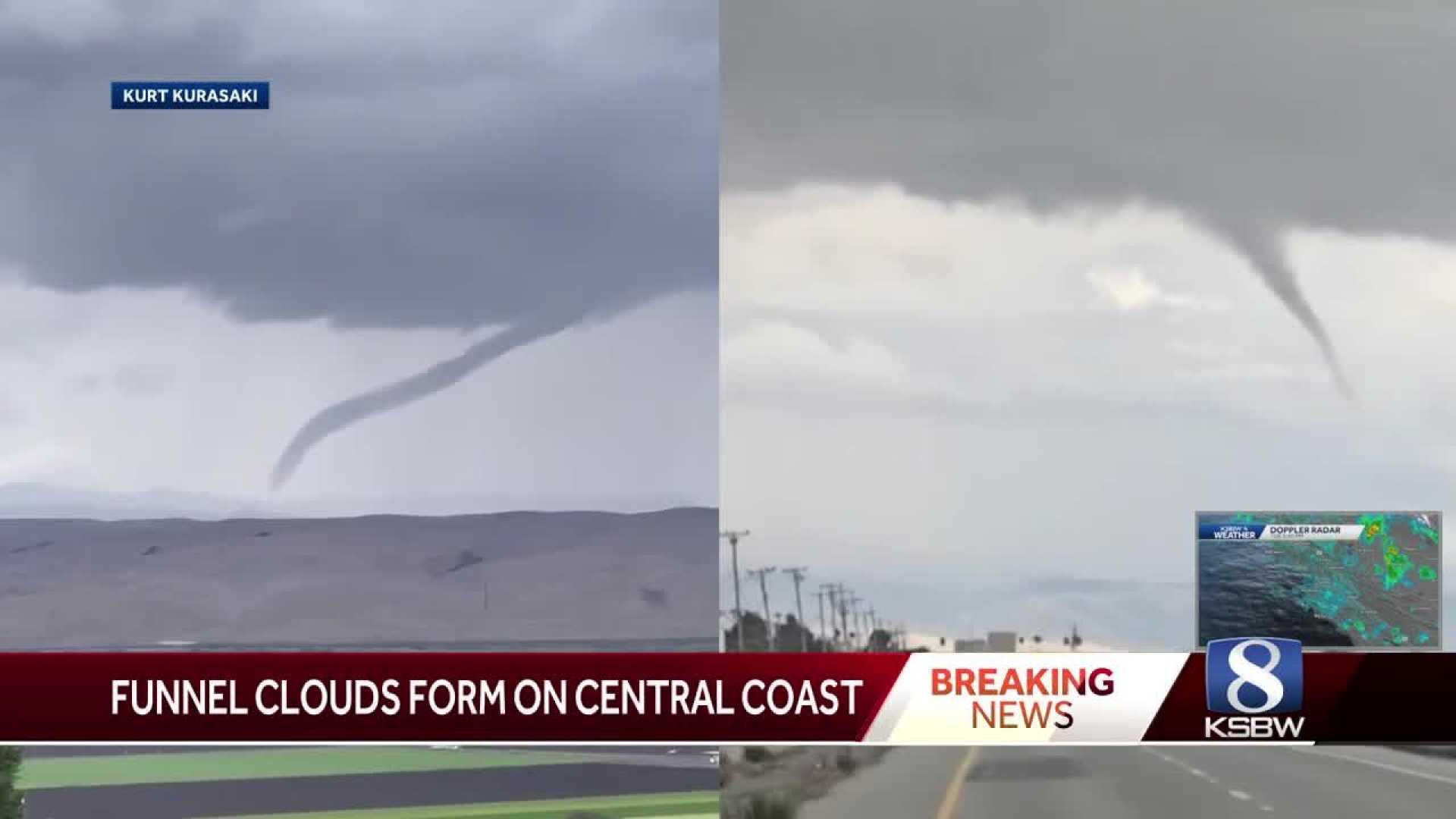
SALINAS, Calif. — Two funnel clouds formed near Salinas and Hollister on Monday, surprising residents and prompting an investigation by the National Weather Service (NWS).
The first funnel cloud appeared in Salinas, quickly followed by another near Hollister, with both formations occurring within 30 minutes of each other. While these funnel clouds resemble tornadoes, they are not classified as such unless they touch the ground, which has not been confirmed for either cloud.
David Chambers, who witnessed the funnel cloud in Salinas, described his experience. “I saw a wall cloud coming over the airport area. As I came back to the office, I told my boss I think there might be a tornado. Everybody chuckled. As we walked around the building, we saw the beginnings of a funnel cloud. Within seconds, we started to see it rolling down. It did not appear to touch the ground, and soon we had intense thunder, lightning, hail, and rain,” Chambers said.
Chambers and his coworkers sought shelter as the storm intensified, watching the funnel cloud dissipate from inside their building. He reassured that they never saw it touch the ground.
The funnel cloud near Hollister is less clear; however, its horizontal nature suggests it is also unlikely to have made contact with the ground. This kind of occurrence is rare for the Central Coast, where residents typically do not see funnel clouds, especially not two in such quick succession.
The NWS is currently investigating the situation. If it is determined that either funnel cloud did touch the ground, further updates will be issued.


