News
Cold Front to Bring Dramatic Temperature Drop to Central Florida
ORLANDO, Florida – Central Florida is set for a significant weather shift as a cold front approaches late Sunday night, following a warm weekend. Temperatures, currently in the mid-80s, are expected to plummet to the lower 40s by Monday morning.
Meteorologist Cam Tran from WESH 2 reports that Sunday will start warm but a cold front will bring storms late in the day. ‘Monday is that transition day where that cold air is starting to filter in, but it will be fully in place by Tuesday morning,’ Tran said.
On Sunday, highs will reach around 85 degrees in some areas. However, as clouds increase throughout the day, rain chances will rise to 40% with the potential for strong thunderstorms. By late Sunday night, temperatures could drop dramatically.
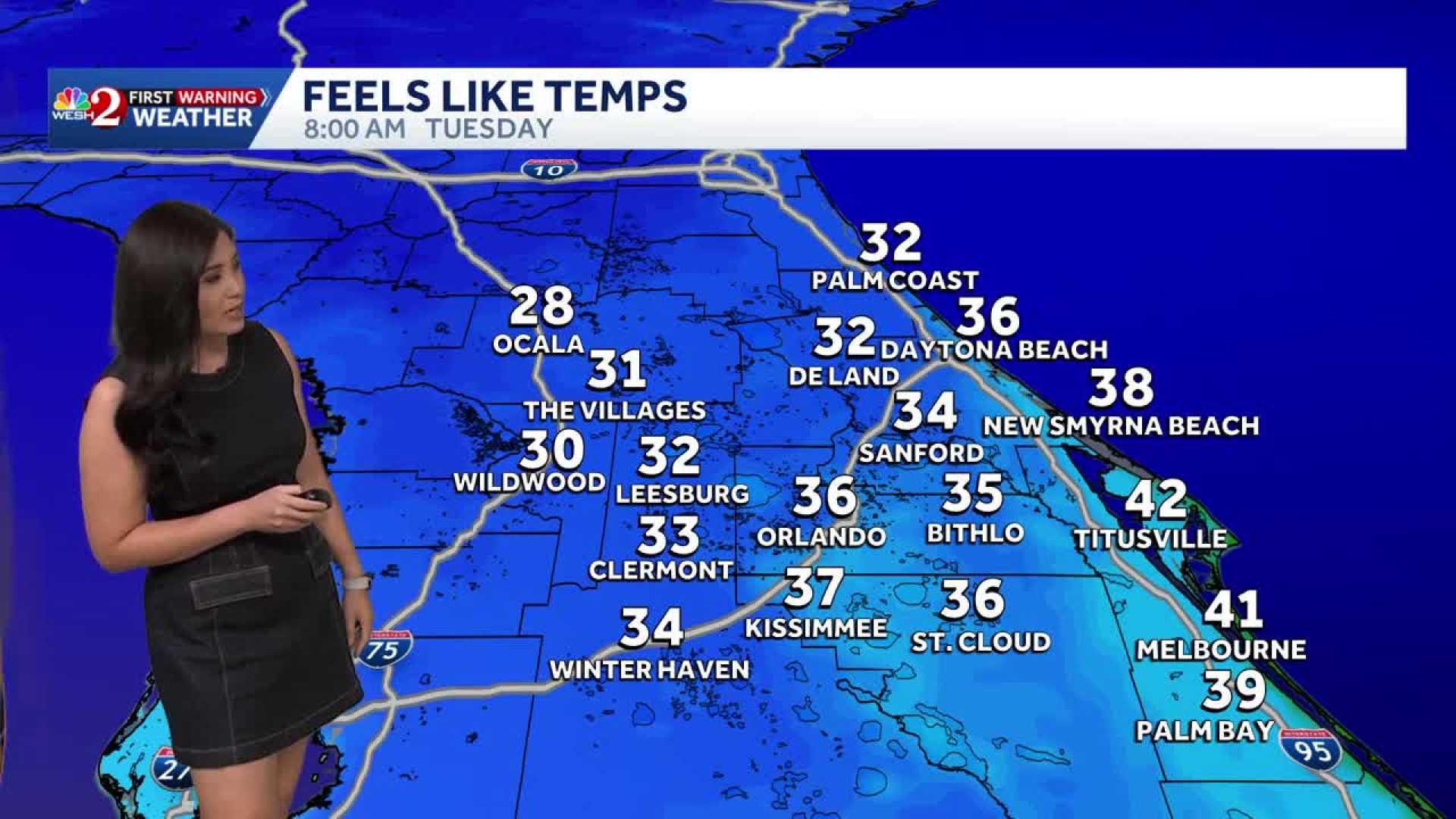
The arrival of the cold front will lead to a significant temperature drop, with Orlando expected to see lows around 42 degrees, while areas like Ocala may experience temperatures as low as 30 degrees. Wind chills could make it feel even colder, particularly on Tuesday morning when feel-like temperatures may dip to the 20s.
Residents are advised to prepare for the sudden cold snap by bringing out winter clothing, as this cold front is anticipated to be the coldest early November outbreak Florida has seen in over 30 years.
According to the National Weather Service, the cold snap will transition to temperatures in the 60s by the middle of the week, but the cold air may linger longer in some areas.
As the weekend draws to a close, expectations run high for colder weather, making it critical for residents to be ready for this unseasonal chill.


