News
Severe Weather Threat Looms Ahead of Thanksgiving Week
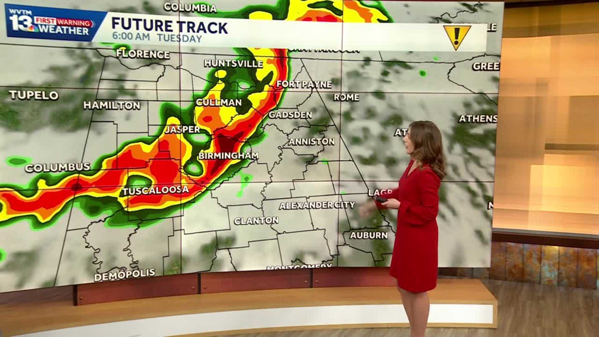
BIRMINGHAM, Ala. (AP) – Rain and storms are moving into northwest central Alabama as the first significant severe weather threat of the fall season approaches. The region is expected to see heavy rain and thunderstorms starting late tonight and continuing through Tuesday.
The National Weather Service predicts that the first round of storms will arrive early Tuesday morning over western counties, spreading eastward through mid-morning. Some storms may become severe, producing damaging wind gusts and possibly hail.
By late Tuesday morning, the intensity of the storms will decrease, becoming more scattered as they move east. However, a second round of storms is expected to redevelop by early Tuesday afternoon, primarily affecting southeastern areas.
This second round may also bring risks for hail and damaging winds, along with the possibility of an isolated tornado. The severe weather threat is expected to taper off after 8 p.m. as the storms exit the region.
Despite the severe weather risks, the rain is a welcome sight for many as the area needs the moisture, with 1 to 2 inches expected in some locations.
As families prepare for Thanksgiving, travel conditions are set to improve. Rain is expected to clear out Tuesday night, making way for cooler, dry weather Wednesday. Morning temperatures will drop into the 30s by Thanksgiving, with highs reaching only the 50s. A freeze warning is also in effect for Friday morning, but Black Friday shopping should see pleasant conditions with highs in the 50s.
Even as Thanksgiving approaches, the Iron Bowl weekend looks to start dry on Saturday with temperatures in the 30s and 50s. However, clouds will increase Sunday, bringing potential for rain by evening.


