News
Arkansas Braces for Strong Winds and Severe Weather Ahead
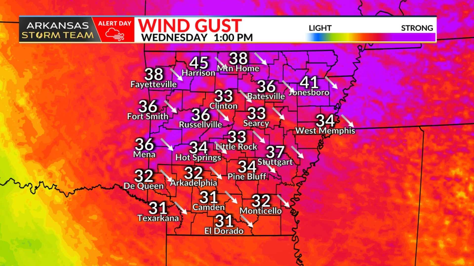
FAYETTEVILLE, Ark. — The National Weather Service has issued warnings for severe weather and strong winds expected in Arkansas on March 18. Chief Meteorologist Darby Bybee reported that Northwest Arkansas can expect wind gusts reaching 40 to 45 mph, while the river valley may see gusts of 35 to 40 mph.
This anticipated spike in wind intensity is part of a larger weather system moving into the region, with a cold front set to arrive late Tuesday night into Wednesday morning, bringing a significant drop in temperatures. Bybee stated, “We’re looking at a strategy of staying aware; fire weather warnings are likely to be reissued given the windy conditions, despite increased humidity.”
The latest weather trends come after a devastating weekend in which tornadoes claimed three lives and caused extensive property damage across Arkansas. On March 15 and 16, the state experienced six tornadoes, including two classified as EF-4, with peak winds recorded as high as 190 mph near the town of Oil Trough.
Governor Sarah Huckabee Sanders assured support for recovery efforts following the storms, visiting affected areas such as Cave City. She committed $250,000 from state disaster relief funds to help those impacted, stating, “We’ll take care of people first and worry about the paperwork later.”
The Arkansas Public Safety Department has reported 32 injuries related to the tornadoes that affected 16 counties, including Baxter, Clark, and Independence. The state hasn’t witnessed two EF-4 tornadoes on the same day since 1997, making the recent events particularly noteworthy.
Additional individual tornado reports included one EF-1 tornado near Gamaliel, where winds reached 100 mph, which also contributed to local power outages. Over 8,500 customers experienced power loss during the storm when fierce winds battered the area.
As the state continues its recovery, residents are preparing for another potentially turbulent weather forecast. Bybee noted that while conditions may briefly improve on March 17, strong winds and fire risks remain concerns. March 19 is expected to be a ‘flip flop day’ whereby temperatures peak early and then decrease throughout the day.
“We are urging everyone to remain vigilant and prepared as we head into midweek,” Bybee advised. “Highs will reach around 50 degrees by afternoon as the next cold front impacts the region.”
Looking ahead, meteorologists are monitoring the potential for severe thunderstorms arriving over the weekend, particularly on March 22. The situation remains fluid, and local officials are dedicated to distributing necessary resources as communities collectively work to restore normalcy.


