News
Back-to-Back Atmospheric Rivers Hit California, Raising Flood and Fire Concerns
LOS ANGELES, Calif. — Back-to-back atmospheric river storms began drenching California on Tuesday, bringing much-needed rain to drought-stricken regions but also raising concerns about flooding, mudslides, and lingering wildfire risks. The storms, which arrived in Northern California earlier this week, have already caused landslides, urban flooding, and road closures, while Southern California braces for its share of the deluge.
The first storm hit Northern California on Friday, followed by a second atmospheric river late Monday. By Tuesday morning, landslides and flooding were reported across the North Bay, including a massive pothole in San Francisco‘s Marina District that swallowed multiple autonomous Waymo vehicles. In Sonoma County, a rain-saturated hillside near the Russian River gave way, sending a home sliding into the water. No injuries were reported.
In Southern California, the National Weather Service estimated a 5% to 10% chance of significant debris flow in fire-scarred areas, particularly near recent burn scars from the Eaton and Palisades fires. As a precaution, the California Department of Transportation closed sections of Pacific Coast Highway and Topanga Canyon Boulevard. “Out of an abundance of caution, the highway must be closed due to soft soils on both the hill and ocean sides of the road,” Caltrans stated in a news release.
Forecasters remain cautiously optimistic that the rain will help replenish vegetation and reduce fire risks, though they warn it won’t be enough to end the fire season entirely. “While the rains will have provided temporary relief with high moisture in some fuel types, the expected rain this week will not be enough to completely end high fire season,” said Kristan Lund, a meteorologist with the National Weather Service in Oxnard.
The storms come after a devastating start to 2025 for Los Angeles County, where wildfires scorched more than 37,000 acres and destroyed over 16,000 structures. A recent report estimated property and capital losses from the fires could range from $95 billion to $164 billion, highlighting the urgent need for wildfire mitigation strategies.
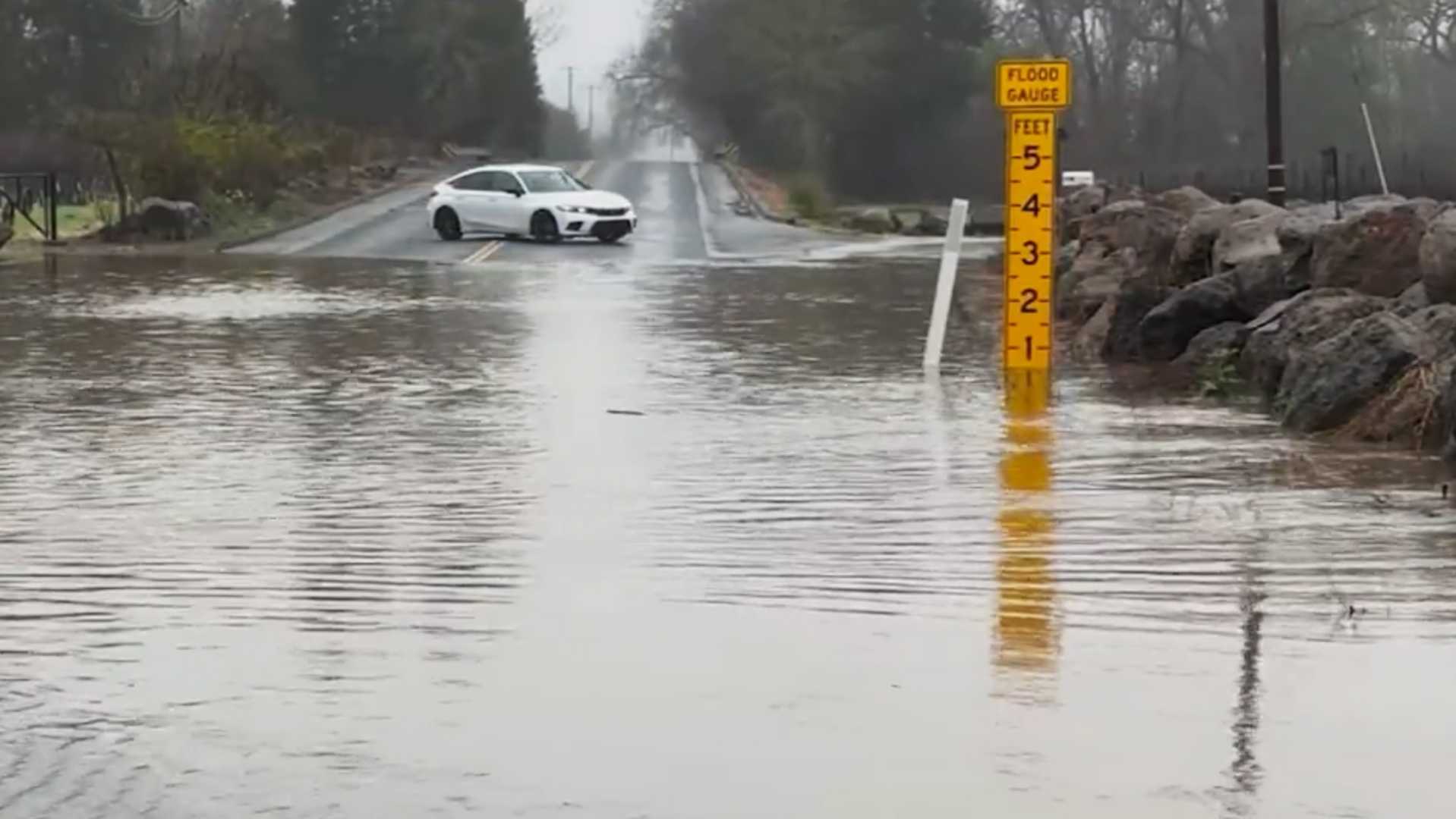
In Northern California, flood watches remain in effect, with the Russian River in Guerneville expected to reach minor flood stage early Wednesday. Evacuation orders were issued for low-lying areas along the river, and schools in some communities were closed due to flooding concerns. In Santa Rosa, a medical facility and nearby hotel were evacuated after parking lots flooded, partially submerging vehicles.
Despite the rain, much of Southern California remains in a significant rainfall deficit. Downtown Los Angeles has received just 0.7 inches of rain since the water year began Oct. 1, only 9% of its typical average. San Diego has fared even worse, with just 0.35 inches of rain, a record low since regional recordkeeping began in 1850.
Forecasters are monitoring a potential storm system developing in the Pacific Ocean, which could bring additional rain by mid-February. However, the jet stream’s current trajectory suggests dry conditions may return later this month, raising the possibility of renewed fire risks if Santa Ana winds develop.
As California navigates the dual challenges of drought and deluge, officials urge residents to remain vigilant. “A little bit of rain and snow goes a long way in the middle of the winter,” said Alex Tardy, a meteorologist with the National Weather Service’s San Diego office. “But we’re not out of the woods yet.”


