Central Florida Endures Heavy Rain with More Expected Monday
ORLANDO, Fla. – Central Florida experienced significant rainfall Sunday morning as a cold front moved into the area, with more rain expected into Monday.
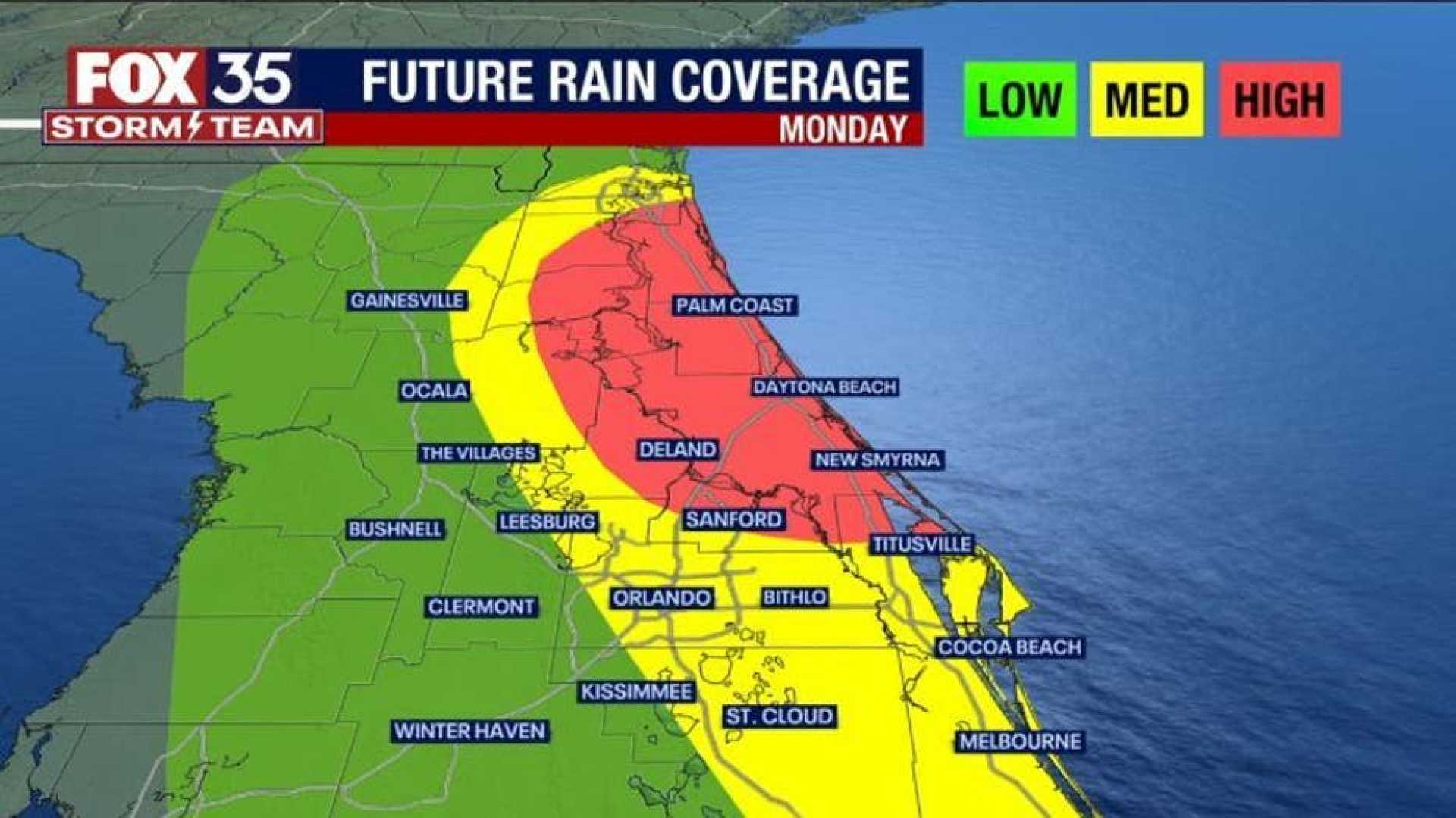
The rain began early Sunday, with Marion County seeing over 2 inches, marking a welcomed change from the region’s recent dry spell. The cold front is anticipated to stall over Central Florida, potentially bringing additional showers on Monday.
Cam Tran, a meteorologist from WESH 2, noted, “Widespread rain is beneficial for our communities. Some areas have already logged over an inch of rainfall.” Current conditions show the heaviest rain affecting counties like Marion and Lake, while lighter rain is moving into Volusia County.
Forecasts indicate that the system will continue to bring rain across the region, with a potential for severe thunderstorms later in the day as atmospheric conditions change. The Storm Prediction Center issued a level one out of five risk for severe weather throughout the afternoon.
As the rain advances toward the I-4 corridor, regions including Orange and Osceola can expect a second wave of precipitation. Tran cautioned that, “The greatest risk of strong storms will be between 12 PM and 6 PM,” suggesting that unstable weather conditions could lead to isolated severe thunderstorms.
The front’s lingering moisture may create challenges for Monday’s forecast, potentially generating additional rain showers. Residents are advised to remain vigilant and keep updated on weather reports.
For continuous updates, viewers can tune into WESH 2 for the latest forecasts and alerts regarding the evolving weather situation.