News
Central Texas Faces Tornado and Severe Weather Warnings Until Midnight
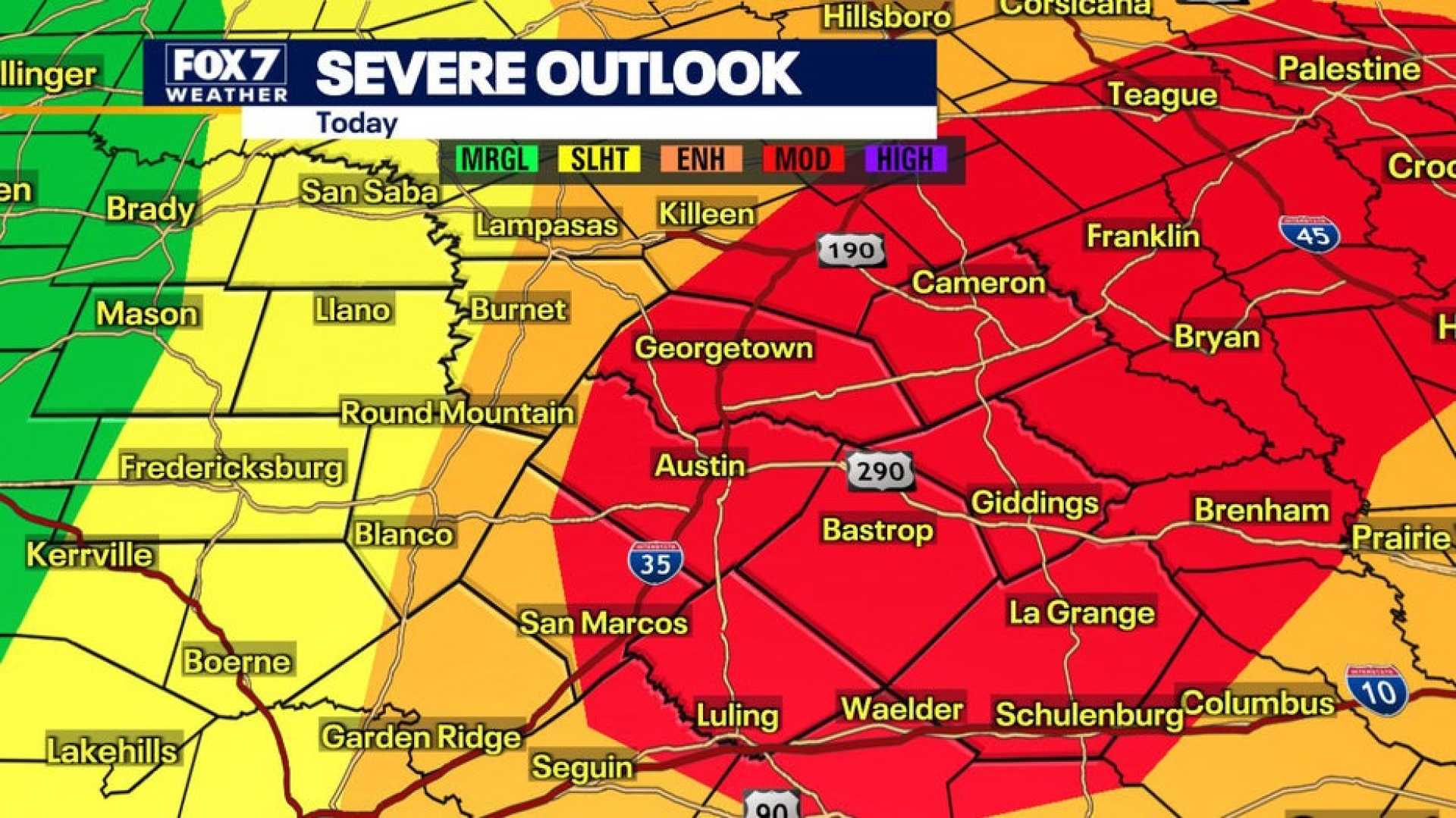
AUSTIN, Texas – Much of Central Texas is under a Tornado Watch until midnight tonight, and several counties have experienced Tornado Warnings throughout the day. The National Weather Service (NWS) has extended the Tornado Watch to include Bastrop, Blanco, Burnet, Caldwell, Gillespie, Hays, Lee, Llano, Travis, and Williamson counties.
Northeastern Williamson County is currently under a Tornado Warning until 9 p.m. At 8:49 p.m., NWS reported a severe thunderstorm capable of producing a tornado near Bartlett, about eight miles northwest of Granger, moving east at 35 mph. The warnings extend to Bell and Milam counties until 9:30 p.m.
A Flash Flood Warning is also in effect until 1 a.m. for Hays, Blanco, Travis, Burnet, and Williamson counties due to concerns over heavy rainfall. Bell, Milam, and Falls counties remain under Severe Thunderstorm Warnings until 9:30 p.m.
Earlier in the evening, at 7:34 p.m., a severe thunderstorm capable of producing a tornado was detected over Flugrath, near Blanco, moving east at 25 mph. Affected areas included Dripping Springs, Blanco, Henly, and Payton.
At 7:08 p.m., another severe thunderstorm was reported near Eckert, about 18 miles south of Llano, moving east at 30 mph, prompting residents in surrounding areas, including Burnet and Marble Falls, to be alert for golf-ball-sized hail and wind gusts of up to 60 mph.
Mason County also remains under a Tornado Warning until 6:15 p.m., with rotating storms reported south of Streeter. The NWS has warned that this could lead to considerable damage to homes and vehicles. They strongly advised those in the area to seek shelter in sturdy buildings, away from windows.
The storms will likely impact the Hill Country between 5 p.m. and 9 p.m., while the Austin metro area should expect severe weather between 7 p.m. and 11 p.m. Eastern counties may see storm activity from 9 p.m. until midnight.
Residents are urged to stay alert and track local weather updates. Heavy hail, damaging winds, and potential flooding in localized areas remain significant risks as the storm front moves through Central Texas.


