Health
Cincinnati Braces for Severe Storms on Weather Alert Day
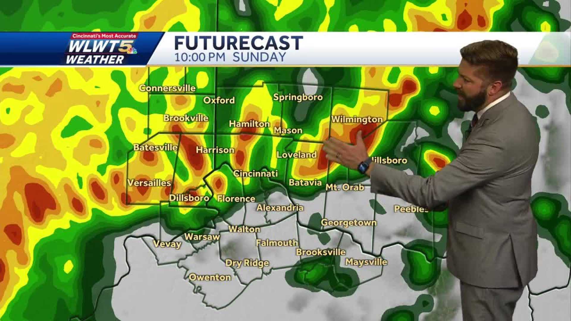
CINCINNATI, Ohio — The Cincinnati area is under a Weather Alert Day as the threat of severe storms looms on Sunday evening. According to the FOX19 NOW First Alert Weather Team, storms are expected to develop after 5 p.m., potentially bringing damaging winds, large hail, and the chance of tornadoes.
The Storm Prediction Center has categorized the region with an Enhanced Risk (Level 3 out of 5) for severe weather, indicating widespread storms with the potential for damaging gusts and severe weather cannot be ruled out. Showers began in the early morning, but a break in activity is expected before the storms approach later in the day.
A spokesperson for the National Weather Service states, “This is a serious situation, and residents should stay weather-aware and prepare for storms as they develop this evening.” Storms are predicted to intensify after 6 p.m., coinciding with the sun setting.
The primary risks include straight-line winds exceeding 75 mph, large hail possibly reaching up to two inches in diameter, and a potential for quick spin-up tornadoes, especially south and west of the I-275 loop. Most dangerous weather is anticipated between 5 p.m. and 1 a.m. on Monday.
“There is a significant chance of seeing severe winds tonight, and people should secure any loose outdoor furniture or equipment,” the spokesperson adds. Rain is expected to continue through early morning on Monday, but temperatures will drop significantly with highs in the 40s, marking a sharp contrast to today’s anticipated high of 72 degrees.
Current radar indicates moderate rainfall affecting areas south of the 7175 split, particularly in Owen County and moving northeast through Boone County. Some heavier showers have also been reported in parts of downtown Cincinnati, including Norwood and Oakley, showing substantial precipitation that could lead to ponding on roadways.
This weather alert comes amid a weather pattern that has been characterized by unseasonably warm temperatures and increased humidity, creating ideal conditions for the formation of severe storms. Residents are encouraged to monitor weather updates as conditions evolve through the evening.
After the severe weather passes, lower temperatures are expected to dominate in the following days, dropping to the 30s and 40s. This cool-down may impact travel on Monday morning, particularly for areas that have the potential to experience the strongest storms.
Looking ahead, meteorologists are also keeping a close eye on Wednesday as another round of severe weather could emerge across the region, emphasizing the need for residents to remain vigilant.
“We are forecasting the potential for another wave of storms, and we’ll keep updating as the situation develops,” the spokesperson concluded. Residents are advised to stay connected to local weather broadcasts and alerts during this active weather period.


