News
Cold Front Brings Fall Relief to San Antonio This Weekend
SAN ANTONIO, Texas — A cold front is set to bring much-needed relief to San Antonio this weekend after a potential record-hot day on Saturday. Forecasters expect temperatures to dip significantly following today’s heat wave.
Chief Meteorologist Chris Suchan reported that temperatures could reach the low to mid 90s on Saturday, potentially tying the 2007 record high of 93 degrees. This evening, residents can expect pleasantly warm conditions for outdoor activities.
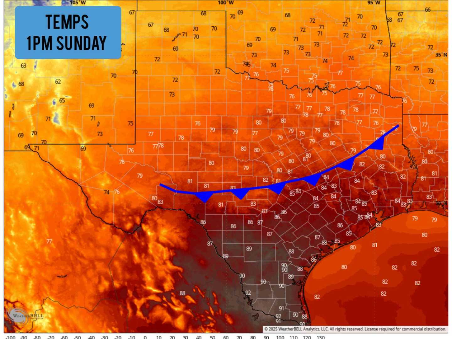
On Sunday morning, humidity will be present as the front passes through. As the day progresses, temperatures are forecasted to stay in the mid 80s under full sunshine, providing a warmer-than-normal day yet with lower humidity, making it feel more comfortable.
The most significant change will occur Sunday night into Monday morning, when temperatures could drop into the 50s across the area, including some neighborhoods experiencing upper 40s. However, this cool air will be short-lived, with temperatures rising back to around 90 degrees by Monday afternoon.
Wind gusts behind the front are expected to range between 20 to 30 mph through 1 p.m. on Sunday, but will weaken later in the day. The low humidity will bring dew points down into the 20s and 30s, heightening wildfire risks in the region. Authorities urge residents to exercise caution with outdoor fires.
Unfortunately, this cold front will not bring any rain, as showers and storms are anticipated to remain limited to East and North Texas through part of Sunday morning.


