Cold Front Triggers Tropical Downpours Across Gulf Coast
TALLAHASSEE, Fla. – A stalled cold front combined with tropical moisture from the Gulf is raising concerns over heavy rain across the Southeast and Gulf Coast. Meteorologists expect spotty downpours starting midweek, creating potential flooding risks.
The FOX Forecast Center reported that the situation resembles the weather patterns that led to a system off the East Coast last week. However, current forecasts show that tropical development from this system appears unlikely.
On Tuesday, a new area of low pressure could form over warm waters off the Southeast coast. While some spinning is anticipated, the system is expected to stay broad and disorganized without quick strengthening.
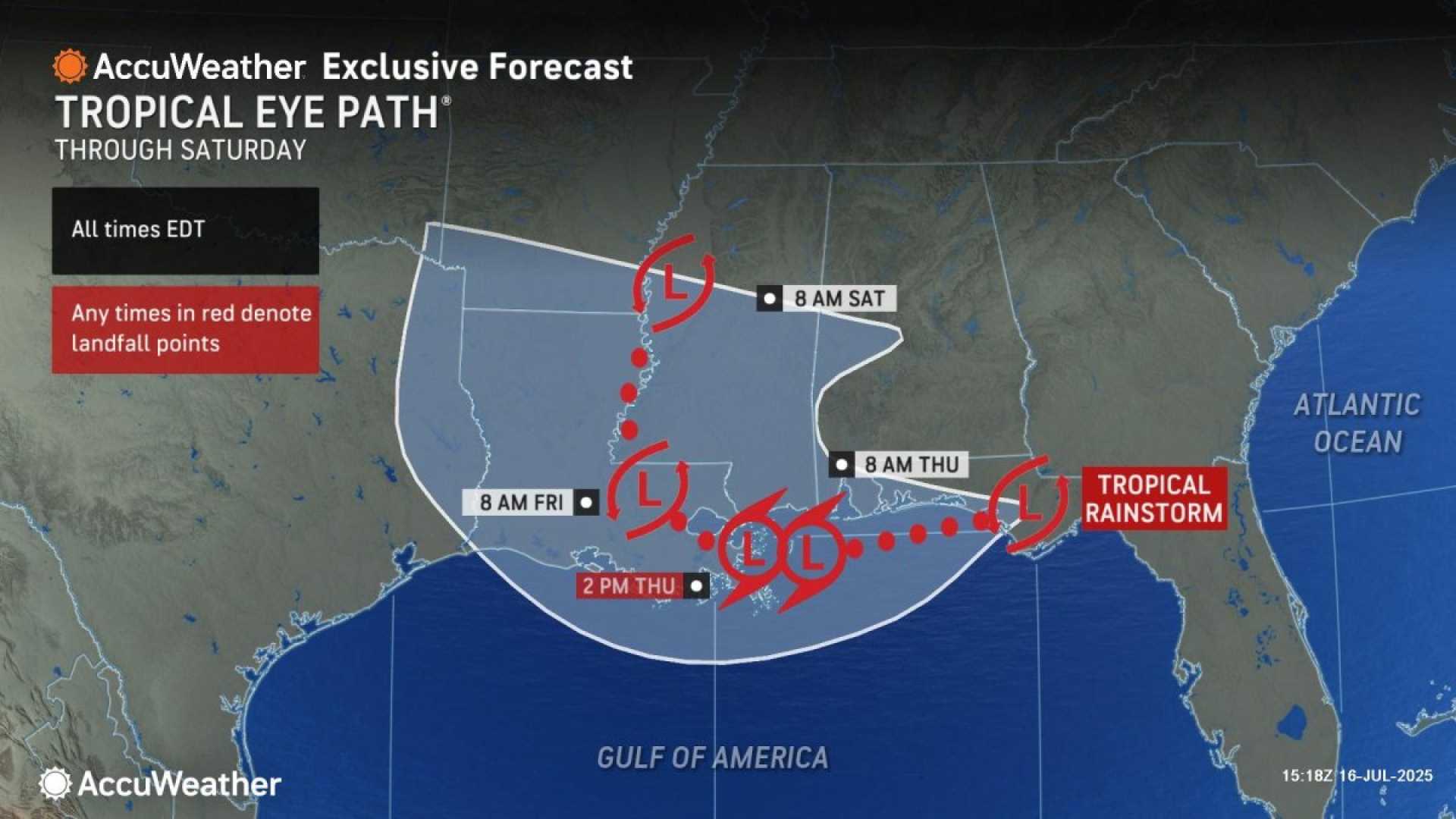
Even without organized development, the system will access abundant tropical moisture, leading to heavy rains from Florida to Louisiana. Areas along the Interstate 10 corridor may experience tricky driving conditions by midweek, persisting through Friday.
Rainfall totals are projected to reach 2-3 inches, with some localized higher amounts possible. Although widespread flooding is not anticipated, isolated incidents could occur where heavy rain lingers.
After the system moves inland, heavy rain may continue to impact coastal regions. The National Weather Service indicates that tropical downpours will likely persist as moisture remains in the atmosphere.
As the week progresses, temperatures across the Gulf Coast may again climb near 100°F, especially as a “heat high” moves toward Texas. Rain chances are expected to return by Thursday and Friday.
The forecast also mentions that another disturbance could develop off the coast of Africa early next week. This system appears to have a better chance of organizing than previous storms this season, suggesting a potential for tropical activity in the near future.