News
Cool Front Brings Rain Chances to Houston Tuesday Evening
HOUSTON – A cool front is set to move through Houston on Tuesday, May 20, bringing chances for showers and possibly a thunderstorm during the evening commute. Meteorologists are tracking a line of showers moving along Interstate 10.
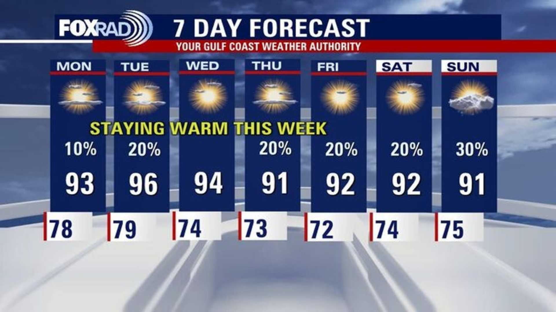
The upcoming cold front will not significantly reduce temperatures, but it will shift winds from the south to the north, ushering in drier air that will help decrease humidity over the next few days. Most areas are expected to start Wednesday morning in the mid to upper 60s and low 70s, providing a brief relief from the heat.
Tuesday’s heat will escalate, with feels-like temperatures reaching the triple digits. The shift in morning lows is welcomed, as residents can expect to enjoy some mornings in the low 70s instead of the typical upper 70s and low 80s.
The front is expected to weaken and stall, potentially leading to a few more isolated showers on Thursday. Meteorologists advise taking breaks if spending extended time outdoors to avoid heat exhaustion as the area acclimates to the summer heat.
As for the Memorial Day weekend, temperatures may dip back into the 80s with rain chances slightly increasing. Current forecasts suggest a 20-30% chance of rain, but adjustments will be made as the date approaches.


