News
Critical Fire Weather Warning Issued for Southeast Texas Amid Cold Front
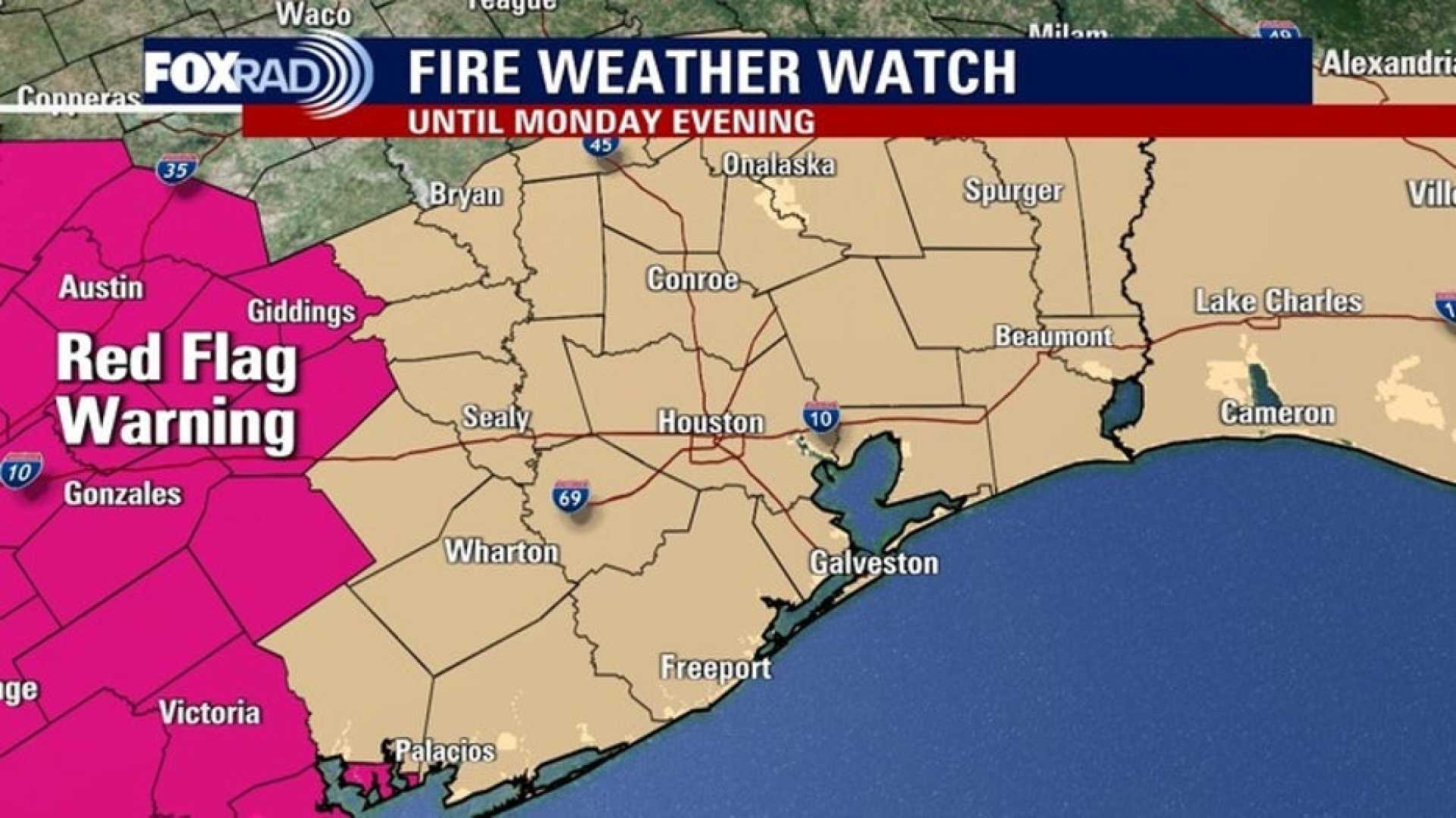
HOUSTON, Texas — A Fire Weather Watch is in effect from Sunday morning through Monday evening for all of Southeast Texas, as gusty winds and drier air following a cold front increase fire danger in the region.
On Saturday, Southeast Texas experienced near-record afternoon highs. However, overnight winds shifted from the south to the north, bringing a rapid change in weather conditions. Meteorologists warn that fire conditions will be critical due to lower humidity levels and gusty winds on Sunday and Monday.
If a fire ignites, it has the potential to spread quickly. Outdoor fires are not advised. Over 130 burn bans remain in effect across Texas, with many in the Houston area, posing additional risks for residents.
The approaching cold front, which may bring a stray chance of showers, will lead to a substantial drop in temperatures from the low 70s to the 40s by Monday morning. Wind gusts are expected to reach 30 miles per hour, significantly lowering the feels-like temperatures to the 20s and 30s.
“The setup includes gusty winds, dry air, and parched brush, creating a high fire danger,” said meteorologist Pat Cavlin. “I’ve never seen this in my almost four years here in Houston.”
Residents are urged to secure loose items outdoors and exercise caution with any tools or vehicles that could generate sparks. As temperatures continue to plummet, lows will drop into the low 40s and upper 30s for northern counties on Tuesday morning.
The season’s first freeze is a possibility with wind chills dipping into the upper 30s Saturday night. Meteorologists project a warm-up later in the week, with highs back in the 80s by mid-week.
Tropical cyclone activity is not expected in the Atlantic Basin in the coming week, with the hurricane season concluding on November 30.


