Dangerous Heat and Storms Expected in Alabama and Florida
BIRMINGHAM, Ala. (AP) – A heat advisory has been issued for Wednesday as high temperatures in Alabama are expected to reach the mid-90s, with heat index values soaring to as high as 105°F. Meteorologists are urging residents to limit outdoor activities and stay hydrated during peak afternoon hours.
The dangerously hot weather will transition as a cold front approaches, leading to increased storm chances. Meteorologist Dillon Gaudet reported that tomorrow morning temperatures will start in the mid-70s before rising quickly in the afternoon.
Scattered showers and storms are anticipated, particularly along and north of Interstate-20. Any storms that form could be accompanied by gusty winds, frequent lightning, and heavy rain. Meteorologists continue to monitor radar trends for storm developments.
Alabama’s weather pattern could evolve into a cooler state early next week, with high temperatures dropping to the mid-80s and overnight lows reaching the 60s. There is even a slight possibility of early-week temperatures dipping into the upper 50s in North Alabama.
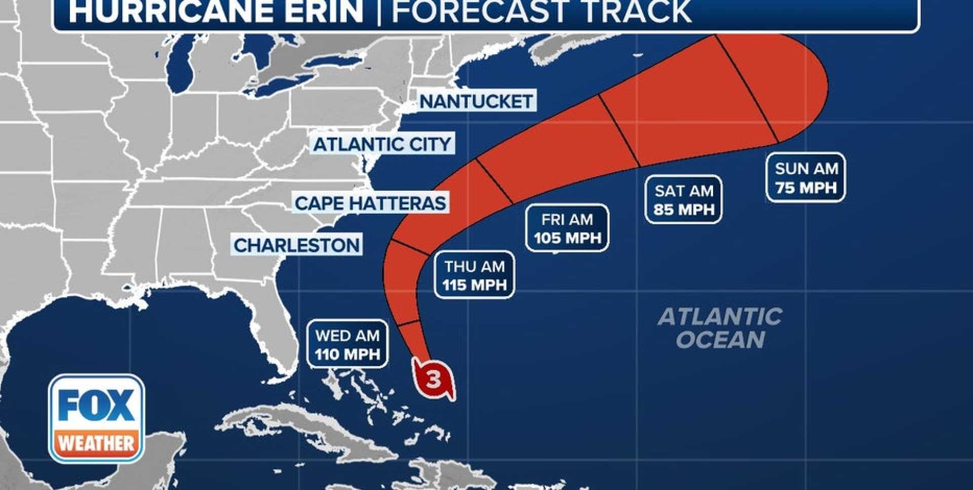
In regard to Hurricane Erin, the storm has been classified as a Category 2 hurricane with maximum sustained winds of 105 mph. Currently located in the Atlantic, it is predicted to remain west of Bermuda and will likely produce significant waves and a high rip current risk along the U.S. East Coast.
Further south, in Florida, two wildfires are affecting air quality in Broward County. Smoke from the fires could reduce visibility to as low as 5 miles. Scattered storms are expected in Florida as well, with afternoon high temperatures hitting the mid-90s and feels-like temperatures nearing 110°F.
Residents are cautioned about these weather conditions as they could impact outdoor activities and safety. It is advisable to stay updated with local weather reports and alerts.