News
Flood Watch Issued as Storms Move Through North Texas This Weekend
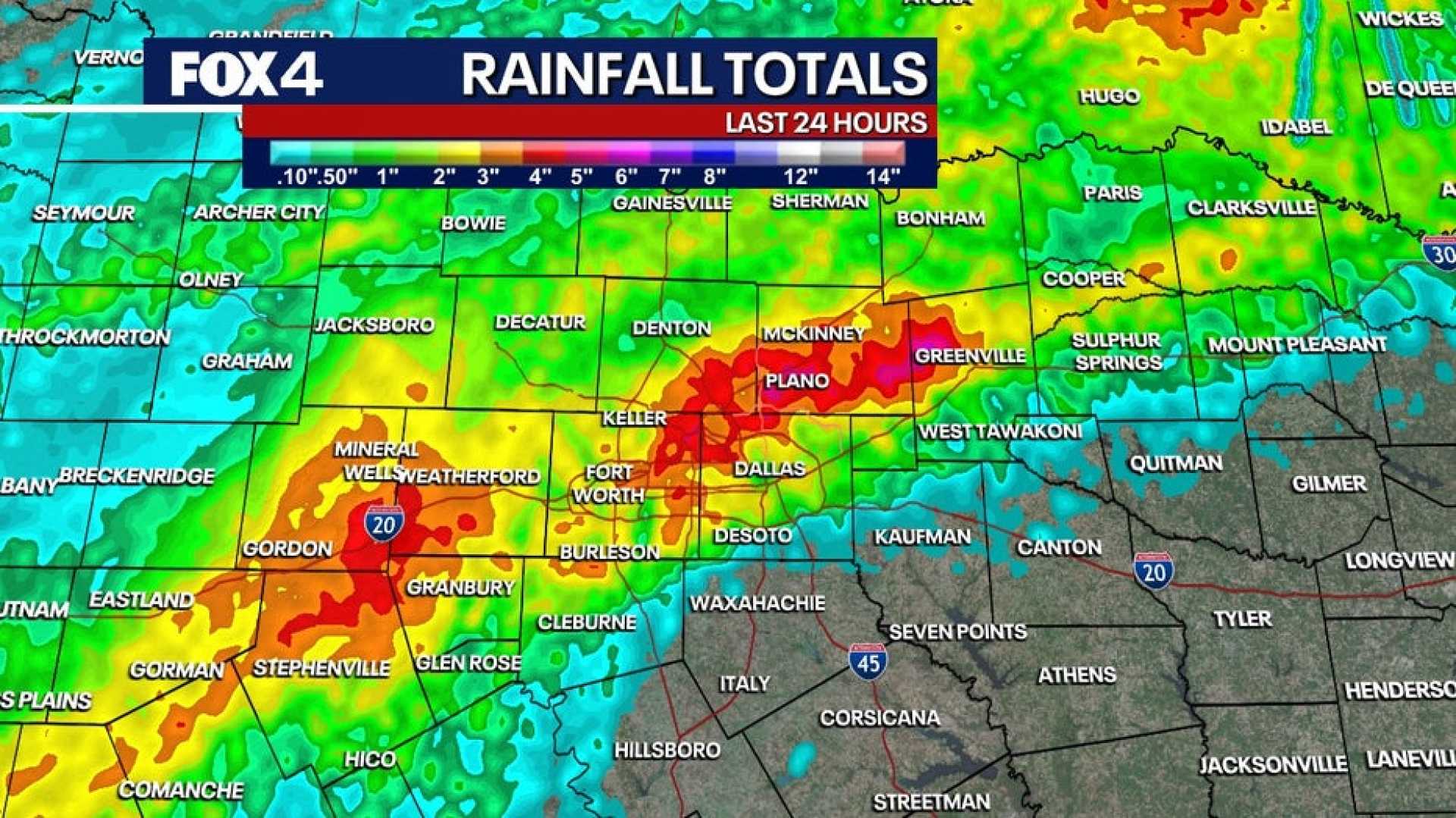
DALLAS, Texas — An area of low pressure is moving through the southwestern United States and is expected to reach the Southern Plains by Sunday evening. This weather system is set to increase rain chances across the region, with isolated shower activity expected west of Interstate 35 on Sunday afternoon.
Rain is anticipated to spread across North Texas late Sunday evening into Monday morning. Due to the saturated soil from recent heavy rains, the flood threat is elevated, prompting a flood watch for the Dallas–Fort Worth Metroplex and surrounding areas that experienced significant rainfall last Thursday.
The National Weather Service has classified Sunday’s severe weather threat as a marginal 1 out of 5 for areas west of I-35, where gusty winds and large hail are the primary risks. The threat for severe weather will increase on Monday for regions in southeastern North Texas and eastern Central Texas, particularly in areas highlighted by the First Alert Weather Team.
Forecasters indicate that for those in the DFW area and west, rain is expected to diminish by midday Monday, leading to dry conditions through midweek. Tuesday will bring more sunshine and temperatures nearing 70 degrees.
On Wednesday, temperatures are projected to drop slightly to the upper 50s, but dry conditions are expected to prevail. For the Thanksgiving holiday, high temperatures will be in the lower 60s under mostly sunny skies.
New rainfall is projected to return next weekend, signaling more wet weather ahead. According to local news reports, additional rain, possibly totaling between 1 to 2 inches, could develop, particularly across flood-prone areas.


