News
Freeze Warning Issued as Cold Front Approaches Charleston Area
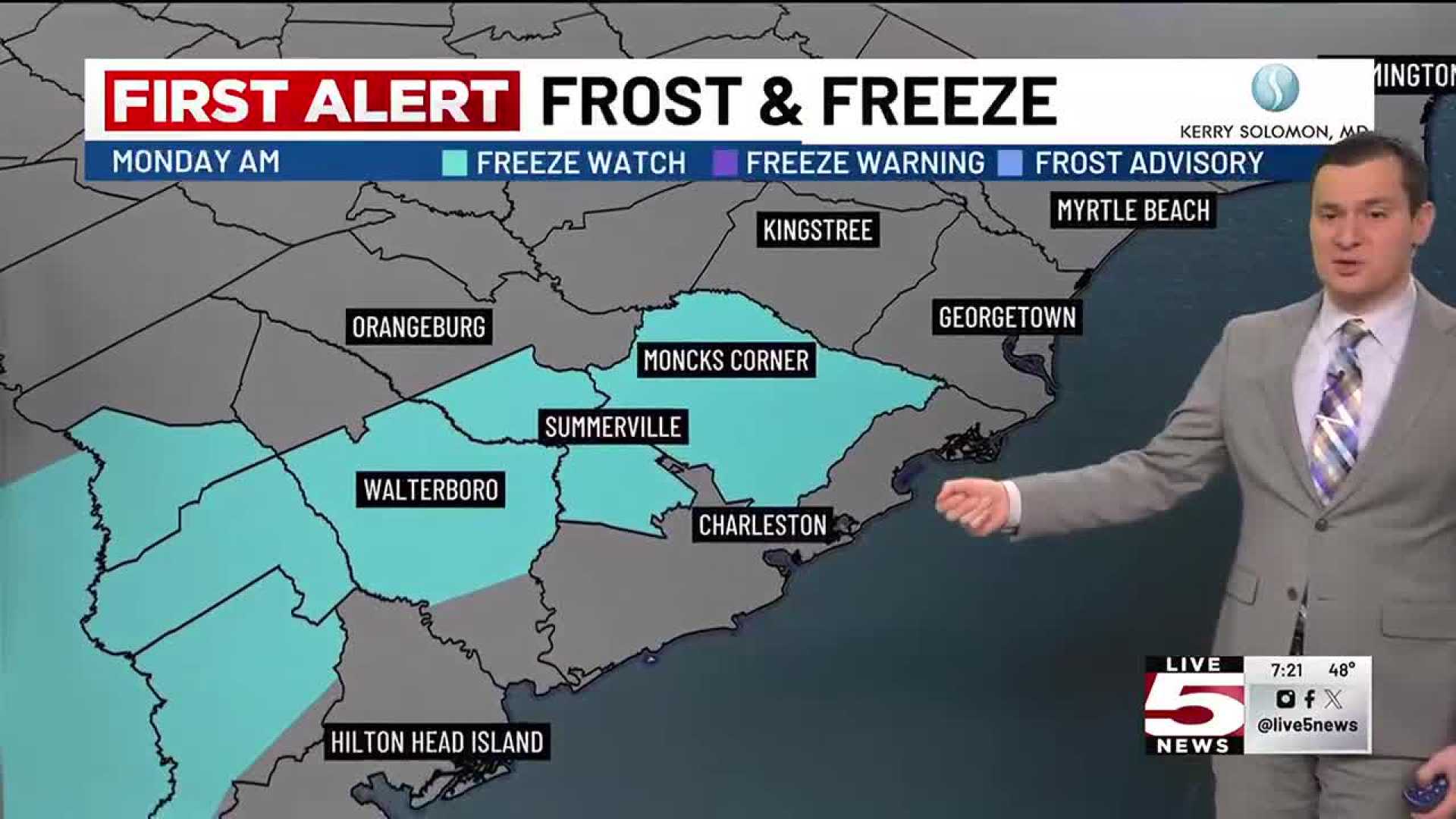
CHARLESTON, S.C. (WCSC) – The National Weather Service issued a Freeze Warning for parts of the Charleston area, effective from 1 a.m. to 8 a.m. on Monday, as temperatures are projected to drop below freezing. The warning affects Berkeley, Dorchester, inland Colleton, and inland Jasper counties, where temperatures could plummet to as low as 29 degrees, according to Live 5 First Alert Chief Meteorologist Bill Walsh.
Coastal counties, including Charleston and Beaufort, will be under a frost advisory with temperatures expected to dip to around 32 degrees. These sub-freezing conditions pose a threat to sensitive plants and local crops, coinciding with the initiation of the growing season along the coast, which officially began on March 1, while inland areas will see the start on March 15.
The National Weather Service is ramping up its frost and freeze alerts to keep residents informed about potential risks to agriculture. Walsh emphasized the importance of taking precautions to protect crops during this pivotal time of year. “It’s critical for farmers to be aware of these warnings and to take steps to safeguard their plants from potential frost damage,” he said.
Looking ahead, a high-pressure system is expected to stabilize conditions at the beginning of the workweek, offering calmer winds and chilly morning temperatures. Following afternoon highs in the 50s on Sunday, overnight lows will drop significantly, leading to a cold start on Monday. The inland areas will likely see temperatures cool into the 20s and low 30s, while coastal areas will remain in the 30s.
Monday’s forecast includes a mix of sun and clouds with afternoon highs ranging from the upper 50s to low 60s. The trend of cool temperatures will likely continue into Tuesday, with overnight lows potentially nearing freezing again in some inland regions.
Weather experts warn of a strong cold front moving through the Southeast by midweek, expected to bring increased chances of strong to severe storms Wednesday. Anticipated hazards include gusty winds, which may reach up to 30 mph. Preliminary reports indicate a possible line of storms could affect the region from late Wednesday morning into the afternoon, leading to an elevated First Alert Weather Day.
Finally, the ongoing dry spells and low humidity levels raise concerns about fire risks throughout Charleston’s Lowcountry area, prompting officials to maintain a burn ban. “It’s essential for residents to exercise caution when outdoors with any fire activity, especially with the ongoing alert for fire risks,” the meteorologist stated.
For continuous updates, residents are encouraged to download the Live 5 Weather app for the latest developments.


