News
Heavy Rain Forecast for Southeast Louisiana on Impact Day
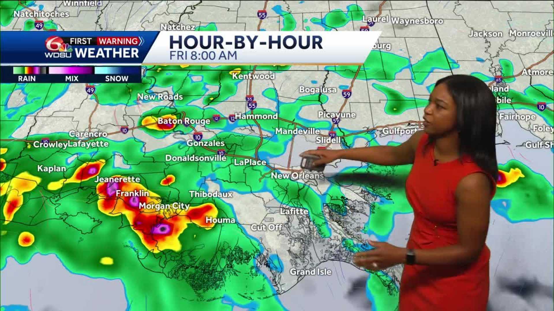
NEW ORLEANS, Louisiana — Today marks a WDSU First Warning Weather Impact Day as heavy rain is expected across Southeast Louisiana. Residents can anticipate rain and thunderstorms throughout the day, with conditions becoming more isolated by late evening.
As of this morning, rain has begun to move into New Orleans and surrounding areas, including parts of the Causeway and Houma. Some areas, such as Waggaman, are currently experiencing heavier rainfall. Commuters in New Orleans should prepare for wet conditions during this morning’s travel.
The National Weather Service predicts rainfall amounts over the next five days will range between 1 to 2.5 inches. Flash flood risks are high today but are expected to decrease over the weekend. Current forecasts indicate a marginal risk for severe weather, particularly as the storm system continues to track towards the east.
In addition to rainfall, there remains a possibility of isolated severe thunderstorms on Sunday for Pearl River and Hancock counties. High temperatures today are expected to be in the mid-70s due to cloud cover and ongoing rain.
On another note, a separate incident reported that three individuals were hospitalized after lightning struck their boat off Venice, Louisiana, during a strong storm that prompted a tornado warning from the National Weather Service. The details regarding their injuries remain unclear.
The ongoing storm has already caused localized flash flooding in affected areas, including the Lower Garden District, and significant rainfall is threatening roadways across the region.


