News
Hurricane Helene Threatens Florida Ahead of Anticipated Landfall

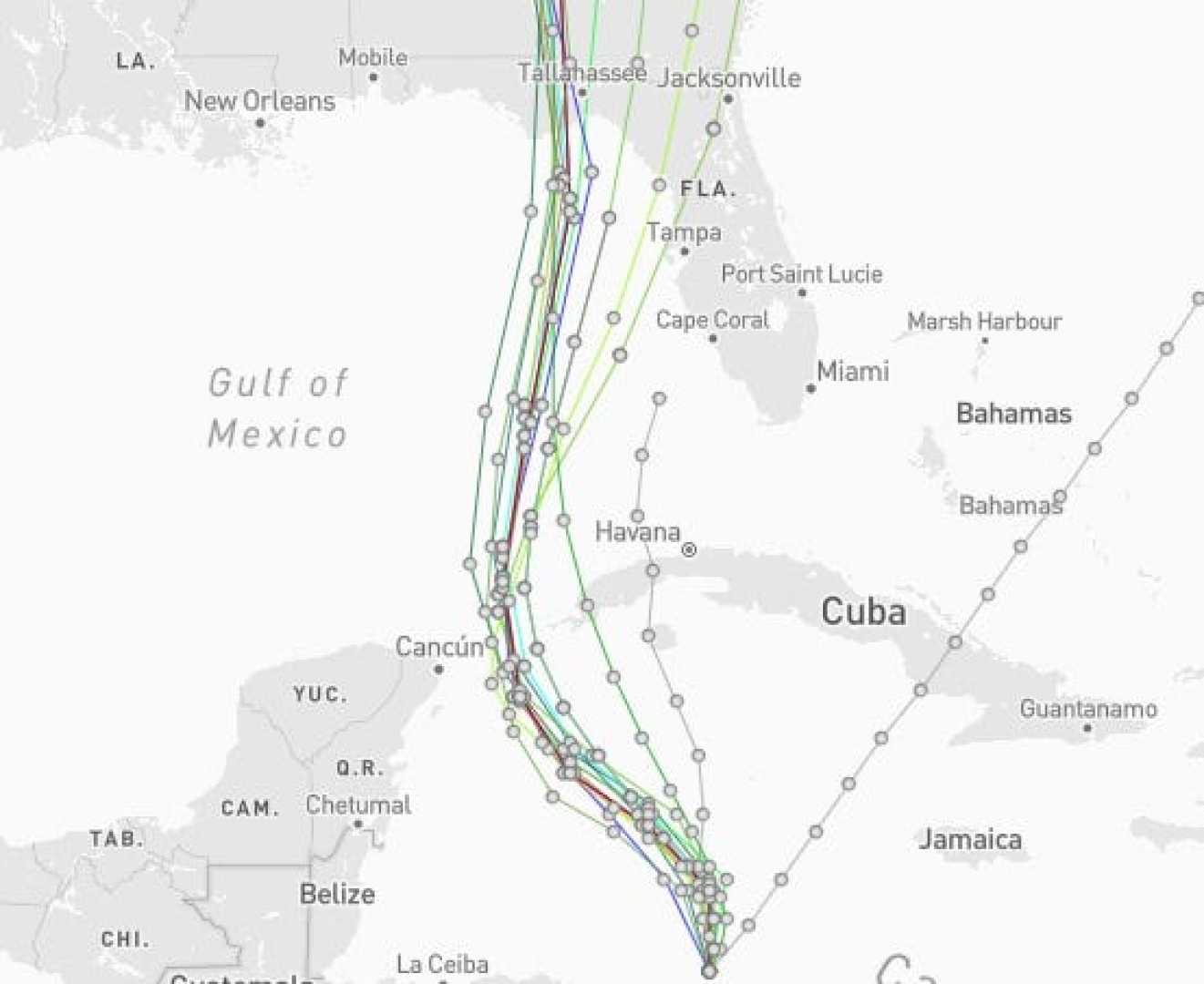
A tropical disturbance in the Caribbean Sea, forecasted to become Hurricane Helene, is gathering strength as it approaches the Gulf of Mexico. The National Hurricane Center has identified the system as Potential Tropical Cyclone #9, indicating its potential to develop into a tropical storm or hurricane imminently. Anticipated to make landfall on the Florida Panhandle or the Big Bend area by Thursday night, residents have been urged to prepare for significant weather impacts.
Hurricane watches have been issued for Tulum and Cancun in Mexico, as well as parts of Cuba, forewarned by meteorological authorities of potential strengthening. Should the system progress as expected, it is likely to evolve into Tropical Storm Helene by early Tuesday. The storm is forecasting to intensify further into a Category 2 or 3 hurricane over the Gulf of Mexico by Wednesday, fueled by unusually warm waters.
Florida Governor Ron DeSantis has issued a state of emergency in 41 counties, including areas susceptible to storm surge flooding. “Now is the time to make an emergency plan, know your evacuation zone, and be as prepared as possible for the storm,” Governor DeSantis announced via social media. Local emergency management is advising Floridians across the state to monitor updates and adhere to preparedness protocols.
The anticipated hurricane is predicted to bring significant rainfall, with projections of three to six inches in the Southeast, potentially hitting isolated areas with up to 10 inches. Flash flooding concerns extend inland to cities such as Tallahassee, Atlanta, and Nashville.
Brian McNoldy, senior research associate at the University of Miami Rosenstiel School of Marine, Atmospheric, and Earth Science, noted record-high sea surface temperatures in the Gulf of Mexico, which have been identified as a catalyst for rapid storm intensification. Climate Central reports these temperatures are even further amplified by climate change. This phenomenon significantly contributes to the storm’s potential power, offering conditions conducive to strengthening Helene rapidly.
The storm’s projected path could affect areas well beyond its center, particularly the Florida Keys through to Tampa, with potential storm surge flooding. Residents are advised not to focus solely on the forecast track’s center line, as Helene’s impacts may extend further than anticipated due to its large size and rapid movement.
As the storm develops and edges closer to the U.S., further advisories, including storm surge and hurricane watches, are expected to be issued covering more of the Florida coastline. The Gulf Coast’s natural topography and shallow coastal waters augment the risk of storm surge, prompting heightened vigilance among those in its path.


