News
Hurricane Milton Strikes Florida, Causes Extensive Damage

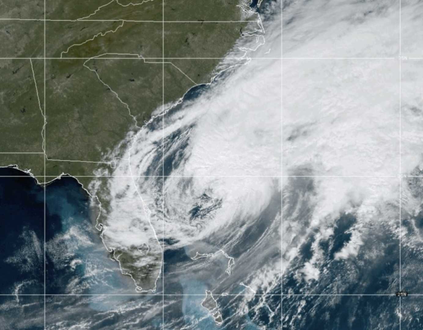
Hurricane Milton has made landfall in Florida, bringing severe weather conditions including life-threatening storm surges, extreme winds, and flash flooding. The United States National Hurricane Center (NHC) has classified it as an extremely dangerous category three hurricane, marking it as one of the most powerful storms to hit the North Atlantic in recent years. This event follows closely on the heels of Hurricane Helene, which wrought considerable destruction across the southeastern United States just two weeks prior.
The hurricane made landfall in Siesta Key, a coastal community south of Tampa, at approximately 20:30 EST on Wednesday (01:30 GMT Thursday), according to reports from the NHC. Wind gusts have been recorded at speeds of up to 115 mph (185 km/h). Meteorologists expect the storm to traverse the center of Florida overnight and into Thursday, before making its way into the Atlantic Ocean later in the day.
Tampa, with a metropolitan population exceeding three million, is among the regions at risk, as it is located just north of where the hurricane initially struck. The NHC has issued warnings for torrential rain, flash flooding, high winds, and potential storm surges, which occur when ocean water moves inland. Predictions suggest storm surges could reach up to 10-15 feet (3-4.5 meters), with localized rainfall potentially totaling 1.5 feet.
Milton, which escalated to a category one hurricane on Sunday, has followed an eastward trajectory through the Gulf of Mexico. Its path included a brief encounter with Mexico's Yucatan Peninsula. The hurricane has experienced fluctuations in strength, at times reaching the peak category five status before weakening slightly prior to U.S. landfall. The hurricane’s core is anticipated to pass over west-central Florida, with substantial storm surges expected along the coast.
On Tuesday evening, the NHC reported a minor wobble in Milton’s trajectory, prompting changes in its projected path. Meteorologists note that even with precise forecasting, predictions can deviate by approximately 60 miles (100 km) when the storm remains 36 hours away from impact. Additionally, residents are cautioned about the possibility of tornadoes spawned from thunderstorms across central and southern Florida.
The situation has prompted Governor Ron DeSantis to initiate what could be the state’s largest evacuation effort in recent years, describing the hurricane as a “monster.” Evacuation orders have been implemented across much of Florida’s west coast, with disaster management authorities coordinating the effort. Designated shelters have been established for those unable to evacuate, while airports in Milton’s projected path have suspended operations, leading to traffic congestion as residents seek to flee.
Hurricanes, also referred to as cyclones or typhoons in different regions, are powerful tropical storms formed in the North Atlantic. They are characterized by strong winds and heavy rainfall. The formation process involves warm, moist ocean air that rises and cools, forming clouds. The movement and cooling of air at high altitudes can result in decreased surface pressure, intensifying wind speeds as the storm strengthens.
The National Oceanic and Atmospheric Administration (NOAA) has anticipated a particularly active 2024 hurricane season, attributing it partially to rising ocean temperatures linked to climate change. Warm ocean waters, about 1-2 degrees Celsius above average in the Gulf of Mexico, contributed to Hurricane Milton’s rapid intensification. Elevated temperatures allow hurricanes to gain energy, often resulting in increased wind speeds and more intense rainfall.
Moreover, the rising global sea levels, which have seen an increase of over 7 inches (18 cm) in Florida since 1970, make coastal flooding more likely during storm surges. The association between climate change and the frequency, intensity, and rapid intensification of hurricanes necessitates further scientific evaluation, but Hurricane Milton’s progression is consistent with the expected trends in a warming climate.


