News
Hurricane Milton Threatens Florida with Category 4 Strength as Evacuations Begin

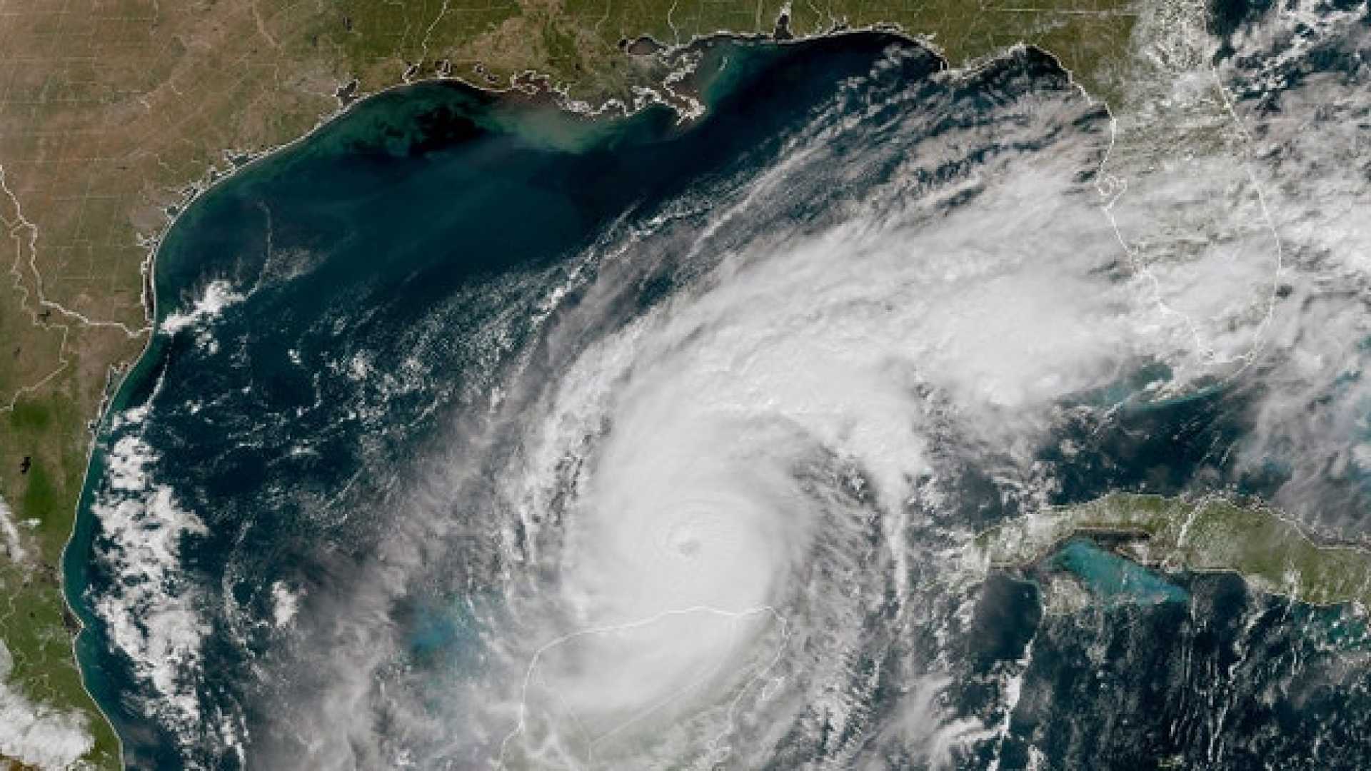
Hurricane Milton, a formidable storm in the Gulf of Mexico, is approaching Florida‘s west coast, prompting widespread preparations and evacuation orders. At 8 a.m. on October 9, 2024, the National Hurricane Center (NHC) reported that Milton had weakened slightly to a Category 4 hurricane, exhibiting sustained winds of 155 mph. The storm is anticipated to make landfall somewhere along the Florida west coast, impacting areas as early as Wednesday night.
As Milton moves northeast at a speed of 16 mph, it is located approximately 250 miles southwest of Tampa. Despite a minor reduction in intensity, the NHC emphasizes that Milton remains a significant threat to the region, warning that critical weather conditions will escalate by Wednesday afternoon. “Preparations, including evacuation if told to do so, should be rushed to completion this morning,” the NHC urged in a statement.
Evacuation orders have been issued in multiple counties, including Seminole, Volusia, and Flagler, after initial alerts led to confusion among residents. Seminole County officials later clarified that the evacuation orders primarily concern those living in mobile homes, low-lying areas, or with specific medical needs.
A storm surge warning is active along the west coast of Florida, from Flamingo northward to the Suwannee River, including Tampa Bay. “Large and destructive waves” are expected, with potential flooding in normally dry coastal areas. In addition, a hurricane warning spans from Bonita Beach to the mouth of the Suwannee River, extending eastward along parts of the Florida coast.
Eric Burris, a meteorologist with WESH 2, stated via Twitter that the storm’s trajectory has shifted slightly north, further heightening concerns for the Tampa area. Residents of central Florida, including Orlando, are preparing for contingencies as the impacts could involve severe wind, rain, and isolated tornadoes, leading to potentially significant flooding and power outages.
The NHC has warned of catastrophic conditions due to projected storm surge and rainfall, with some areas potentially receiving up to 18 inches of rain. Coinciding with the recent impact of Hurricane Helene in the Florida Big Bend region, widespread recovery efforts from previous damaging storms are ongoing, further complicating preparations.
To stay informed about the hurricane’s progression and local advisories, residents are encouraged to keep abreast of updates through the First Warning Weather team at WESH 2, which includes Chief Meteorologist Tony Mainolfi. The next advisory from the NHC is expected at 11 a.m.


