News
Indiana Braces for Severe Storms After Warm Weather Today
INDIANA, USA — Indiana is experiencing a drastic change in weather today, April 17, as temperatures soar into the high 70s and low 80s, but severe storms are predicted to roll in after 10 p.m. Residents are advised to prepare for a stormy night after enjoying the unseasonably warm afternoon.
The warm conditions are accompanied by southerly winds, with gusts expected to reach up to 40 mph, potentially making it feel cooler outside despite the warm temperatures. This combination of heat and humidity is a precursor to severe weather later this evening.
According to forecasts, the most intense storms are anticipated to occur between 10 p.m. Friday and 7 a.m. Saturday. Meteorologist Matt Standridge from 13News warned of heavy rain and lightning, with expected rainfall ranging between 1 to 3 inches across the state over the weekend. While the overall threat level is considered lower, isolated severe storms could still pose risks of wind gusts exceeding 60 mph.
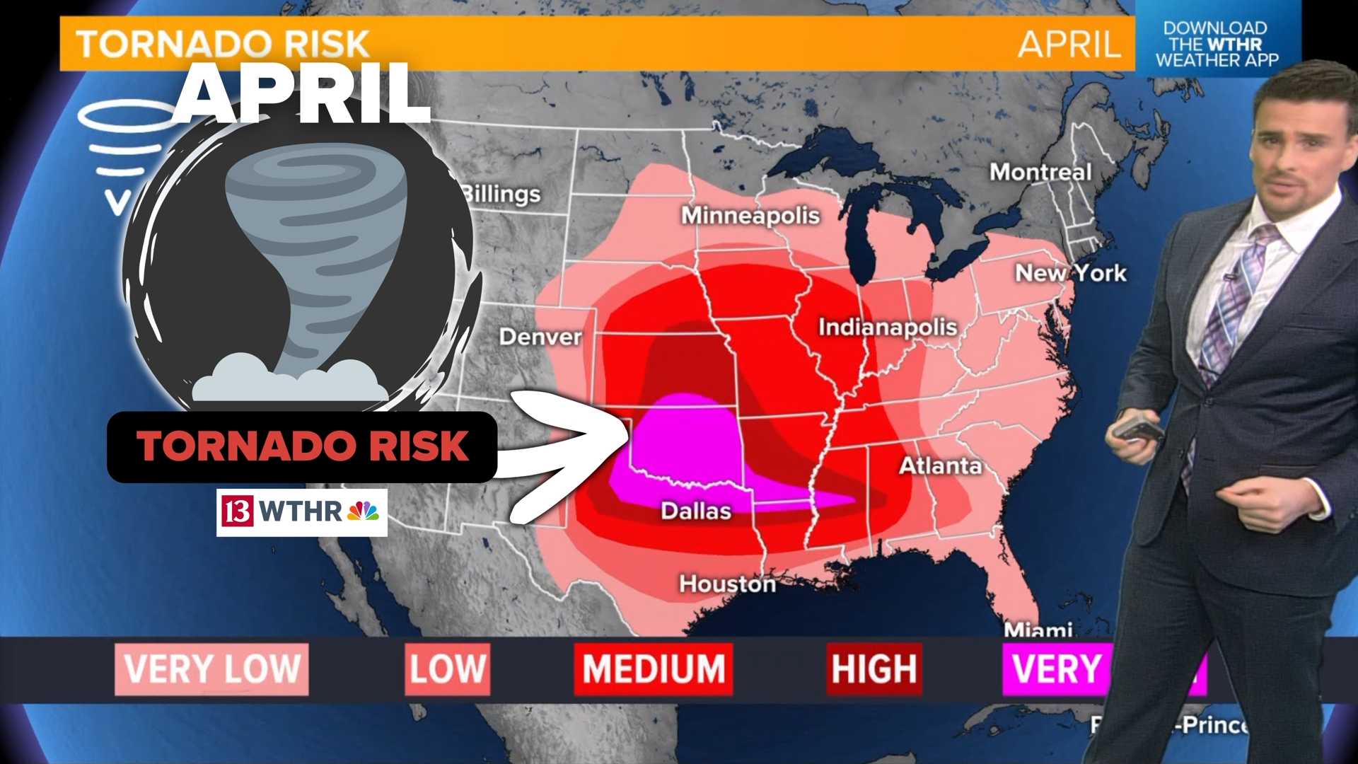
“While we expect batches of heavy rain, we need to remain cautious as a few storms might develop into severe conditions,” Standridge stated. He emphasized that hail and tornado risks remain low but not entirely ruled out.
As the storms move through, certain areas in Indiana, especially north and west of Indianapolis, are under a level 2 severe threat, indicating a more significant risk of severe weather. In contrast, the risk diminishes further south.
Standridge noted that following the initial storm wave, additional storms may continue into Saturday morning. The forecast indicates that conditions may remain conducive to strong winds as the day progresses, particularly south of Indianapolis.
After Saturday, the weather outlook suggests a continued chance for rain throughout Easter Sunday, particularly in the morning hours, with some drier periods possible later in the day. Depending on the storm’s progression, there may still be lingering rain into Monday as well.
“While the situations can evolve quickly, it’s prudent for residents to keep an eye on the forecasts as systems develop,” Standridge recommended, urging caution for any outdoor plans during the holiday weekend.
The ongoing weather pattern is attributed to developing upper-level low-pressure systems which could enhance storm activity leading into Easter weekend. This follows a tumultuous start to the month, where Indiana faced tornadoes and flooding, leaving many wondering about the stability of the weather.
The National Weather Service is closely monitoring the situation, highlighting that with the potential for chaotic upper-level wind patterns, more thunderstorms could materialize as the weekend progresses.
To stay informed and track the incoming weather, residents can utilize local radar resources. As heavy rain is expected through the weekend, those planning outdoor activities may want to consider alternate arrangements.


