News
Kentucky Braces for Snow as Ohio River Peaks at 55 Feet
CINCINNATI, Ohio — The Ohio River is expected to crest at approximately 55 feet on Wednesday morning, coinciding with the arrival of the first of two anticipated rounds of snow across the region. A Winter Weather Advisory is currently in effect for several Kentucky counties.
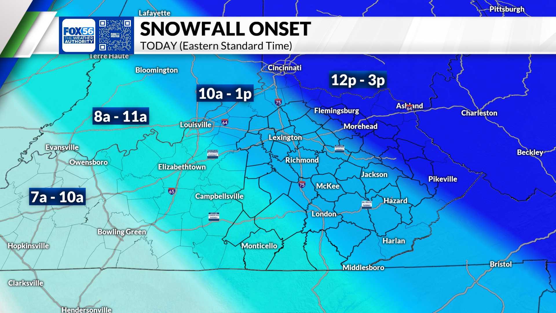
As of Wednesday morning, snowfall is predicted to largely impact areas in Kentucky, with potential accumulations of one to two inches. North of the river, particularly in Cincinnati and surrounding areas, only a dusting may occur. Drivers in Kentucky should prepare for slick spots due to the expected snow.
“We’re monitoring this winter storm closely, especially with the upcoming cold front and snow accumulation expected this week,” said a local meteorologist. “While Kentucky is set to receive significant snowfall, we may only see light flurries in Cincinnati and regions north.”
The advisory covers Bracken, Carroll, Gallatin, Grant, Lewis, Mason, Owen, Pendleton, and Robertson counties, with effects lasting until noon on Wednesday. The best chance for accumulating snow in those areas will be this morning, while the precipitation is expected to decrease by mid-afternoon.
“There’s a sharp cutoff north of the river for the snowfall, where any accumulation will be minimal,” the meteorologist added. “However, as the ground is frigid from recent temperatures in the teens, anything that falls will likely stick, leading to hazardous travel conditions, especially in southern Kentucky.”
A second round of snow is anticipated later Wednesday night, starting after 10 p.m. This weather event could bring an additional fluffy inch before dissipating early Thursday morning. There is a forecasted warm-up arriving this weekend, with temperatures expected to rise into the 30s, and potentially close to 50 degrees by next week.
The current Ohio River level has raised some concerns, especially as it approaches the crest. Although some areas are witnessing road closures due to high water levels, officials have indicated that there are no major flooding concerns at this stage.
<p"It’s noticeable that the river is high, which usually leads to temporary road issues near the riverbanks, but these are routine and expected with higher water levels," the meteorologist said, assuring residents that precautions are already in place.
Residents are advised to stay informed about weather changes and prepare accordingly for possible slick and hazardous conditions as snowfall is projected to continue intermittently in the coming days.


