News
Massive Storm System Threatens Tornadoes and Blizzard Across U.S.
WASHINGTON, D.C. — A powerful storm system is sweeping across the United States, bringing severe weather conditions including tornadoes, strong winds, and blizzard conditions that are expected to create dangerous travel situations from Texas to the East Coast. This storm, which began forming over the Rockies, has rapidly intensified and is projected to reach near-record strength for March as it moves eastward.
The National Weather Service (NWS) released severe thunderstorm and blizzard warnings as more than 29 million people from Florida to Pennsylvania are under a level 2 of 5 risk of severe thunderstorms. Damaging wind gusts and potential tornadoes have been forecasted in these areas.
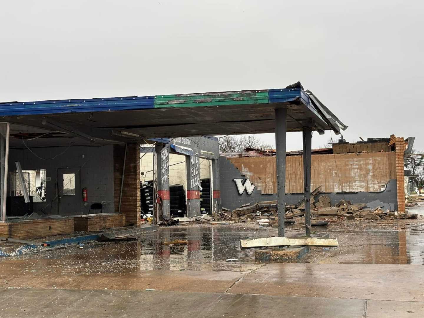
Wind gusts in multiple states have reached upwards of 70 mph, with Texas and Louisiana experiencing the greatest impact, resulting in two reported fatalities in Madison County, Mississippi. Storm-related incidents include one person who died from electrocution and another crushed by a fallen tree, according to local authorities. As a result, over 458,000 homes and businesses across Texas, Louisiana, Oklahoma, and Mississippi are without power.
The Storm Prediction Center has alerted residents to a particularly critical fire danger in Texas, with the potential for rapidly spreading wildfires given the dry soil and strong winds. In southern San Antonio, strong winds caused multiple house fires, prompting emergency evacuations. The NWS warned that any spark could rapidly escalate into a major fire in these conditions.
As the storm progresses, it is expected to create severe thunderstorms with damaging winds, hail, and possibly tornadoes, particularly in the southern U.S. Severe thunderstorm warnings extend over Louisiana, Arkansas, and Mississippi where strong tornadoes are likely to form. The storms are anticipated to intensify as they move through the region, particularly over the Dallas-Fort Worth metroplex, which is already experiencing severe wind conditions.
In anticipation of Mardi Gras celebrations in New Orleans, city officials have taken precautionary measures, shortening parade routes and rescheduling events due to the risk of severe storms. The city is currently under a level 3 of 5 severe thunderstorm risk. Police Chief Anne Kirkpatrick emphasized the significance of public safety while acknowledging the city’s global reputation for its Carnival celebrations.
Further north, blizzard warnings are in effect for parts of Nebraska and Kansas, where visibility is expected to drop to near-zero due to blowing snow and strong winds. The NWS has issued warnings for perilous travel conditions and has advised residents to avoid traveling unless absolutely necessary, particularly during the evening commute.
As the storm continues its path toward the Northeast, airport hubs in Chicago and New York City are bracing for disruptions. Already, more than 500 flights have been canceled, with thousands of delays reported as strong winds continue to affect air travel. Utility crews are racing against the clock to restore power to affected residents in anticipation of continued severe weather.
By Thursday, while the precipitation is likely to taper off, lingering gusty winds will continue to impact much of the eastern U.S. Residents are urged to remain vigilant and stay updated through local weather services.


